Hi! Welcome to my Colorado State Hiking Page!....(Keep scrolling down for hikes)
Hope this helps guide you to find some great hikes!
I spent a couple months in Colorado, mostly to hike, and would love to share with you what I loved. No, I definitely haven't done them all (and haven't explored all areas of Colorado yet), but I did do many hours of research in trying to find some amazing ones, and many great hikes (and some not so wowing) I found.
I have divided hikes by area in Colorado (although some are kind of in-betweens).
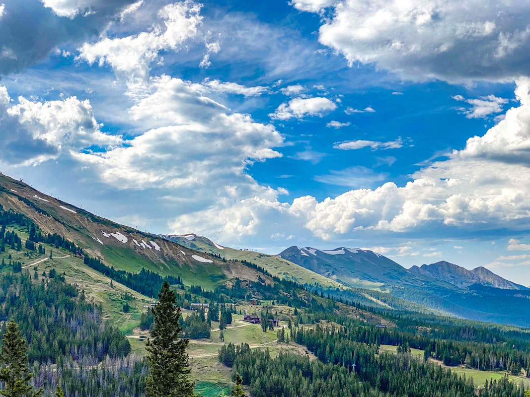
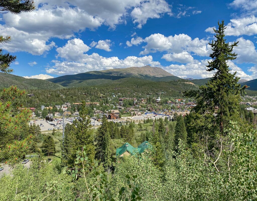
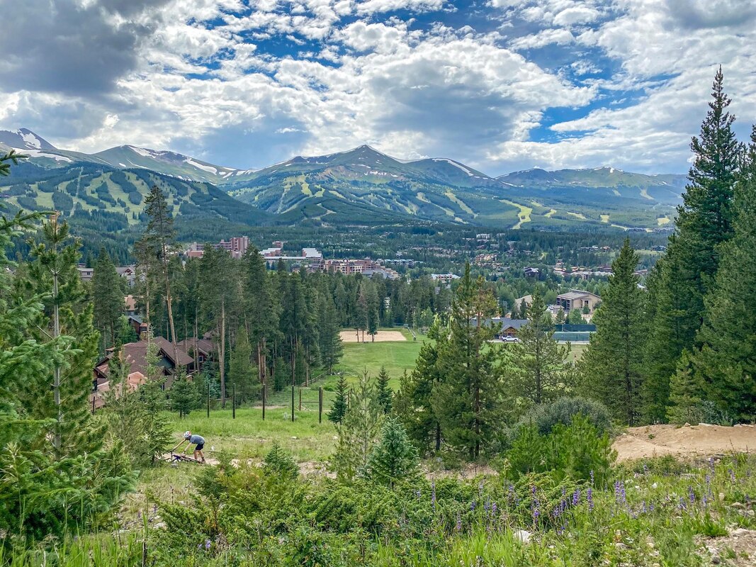
I start with Breckinridge area (because I stayed there the longest and hiked in that area probably more than any other. FYI, Breck is an AMAZING place to stay for hiking (and in general). The Breckenridge Section also Includes nearby areas of Alma, Dillon, Frisco, Keystone, and even Terryall.
I then have a section for Aspen, another section for Vail, one for Arapaho National Forest (which is quite a big area), then a group that includes Boulder, Denver, and Colorado Springs, a section for Rocky mt. National Park, then a Northern Colorado section (mostly Fort Collins and Loveland), and finally Southern Colorado.
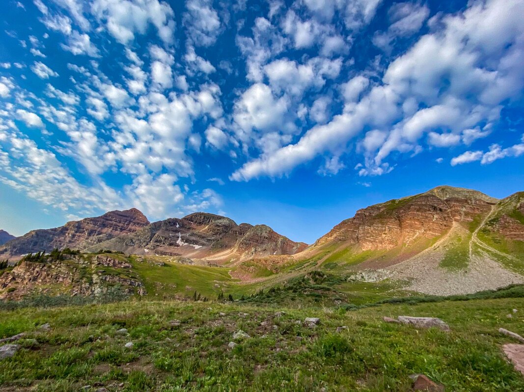
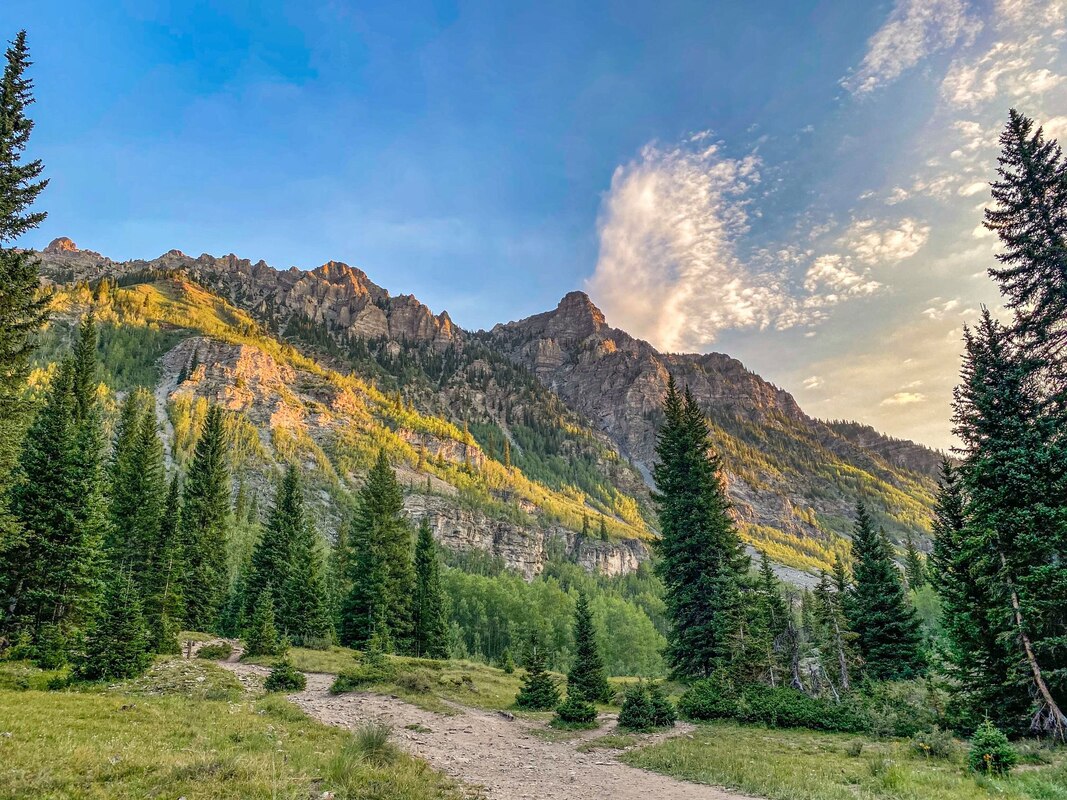
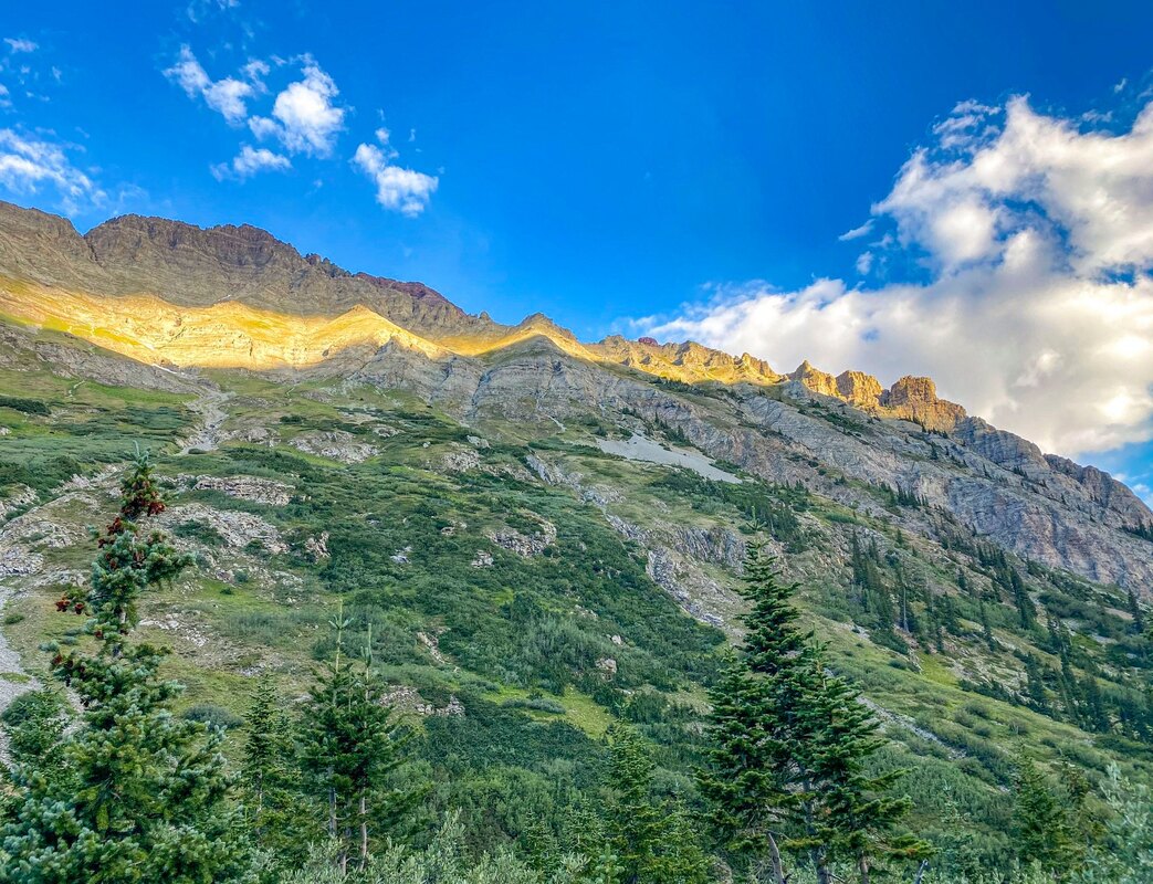
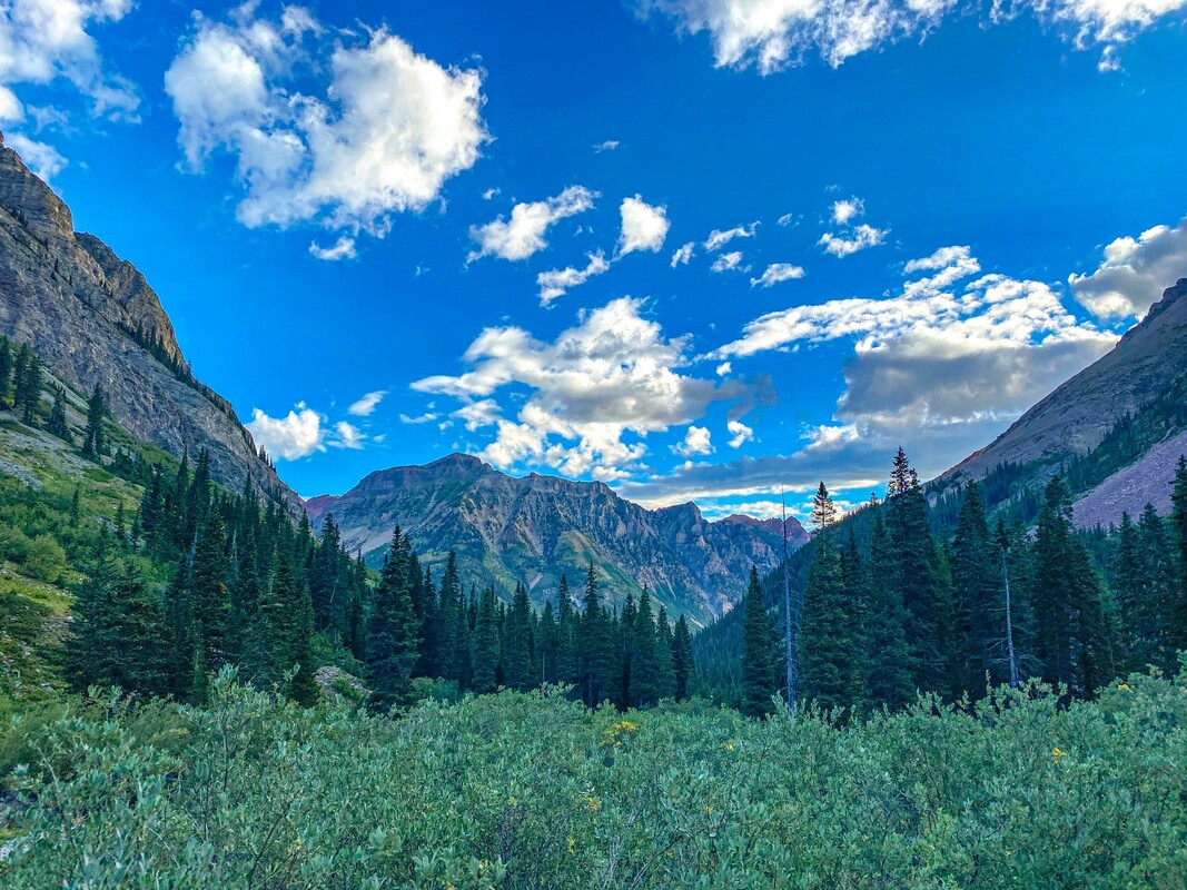
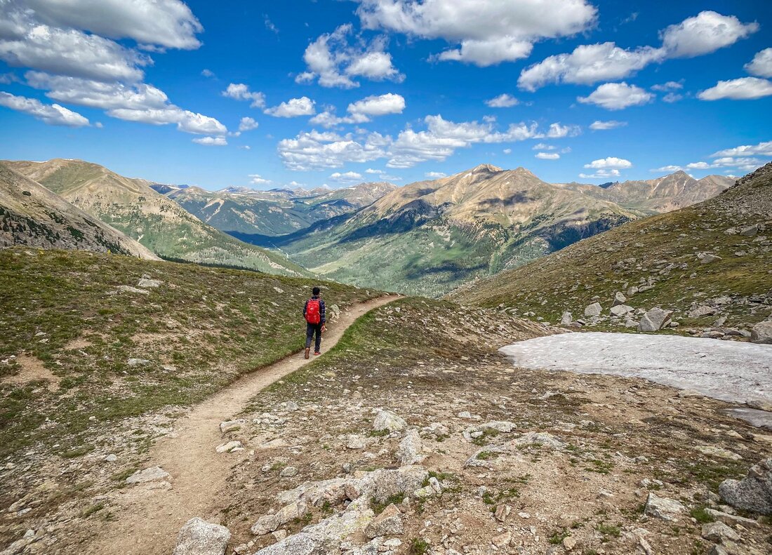
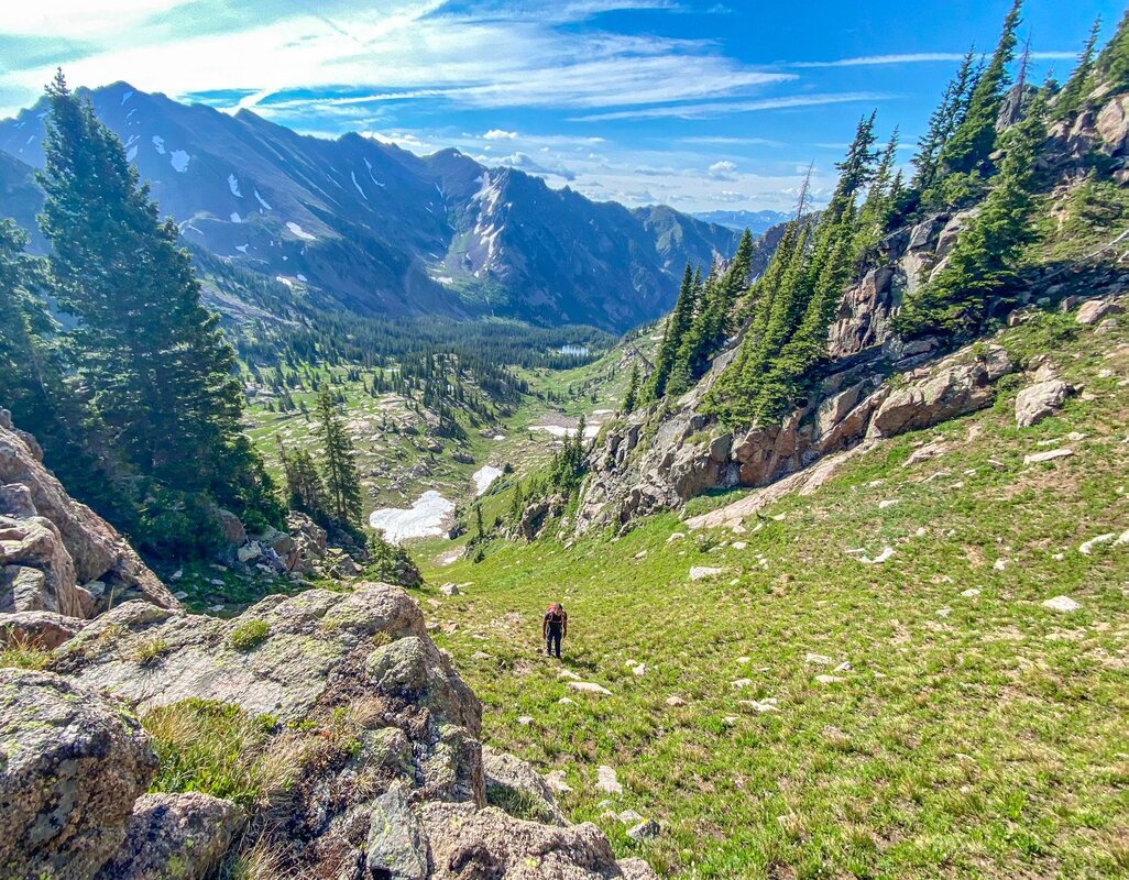
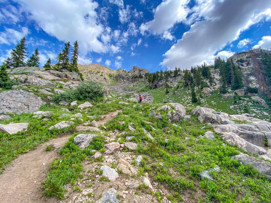
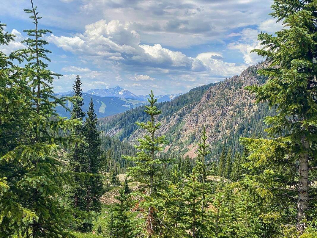
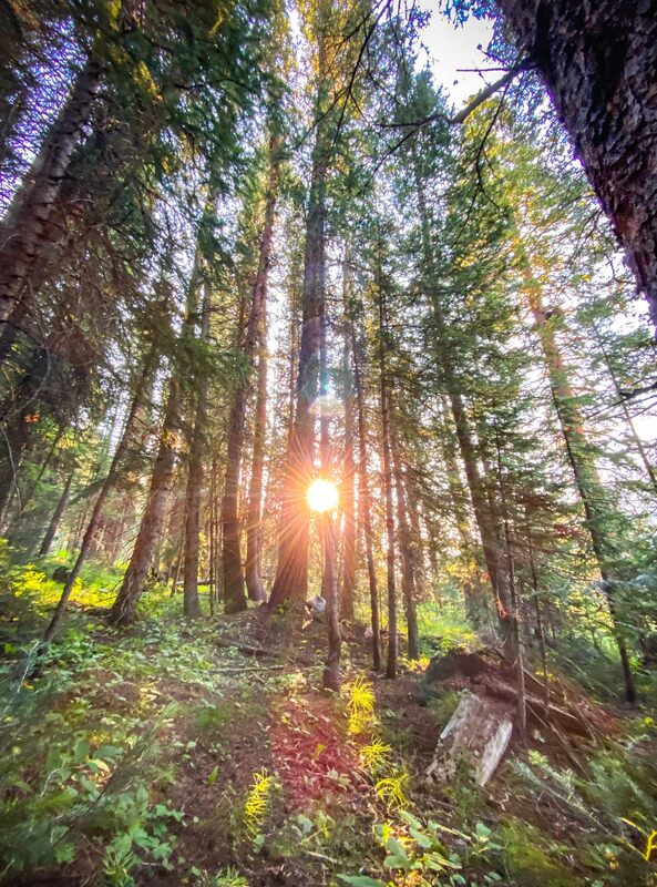
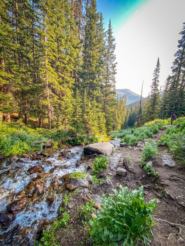
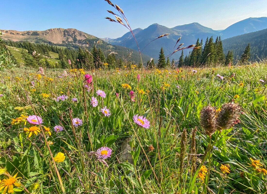
Photographs help me a lot in my search for hikes, to help me get a feel for what I will see on a hike. Therefore, I have included a gallery in each hike section with a photograph(s) of each of the hikes. If you hold your cursor over the picture (or click on the picture), a description noting what hike you are looking at will appear. Then you can go to the hike description written below.
....Or you can just go to the hike descriptions and see what works for you, then check out the photos. I have given ratings (3*, 4*, 5*), approximate miles (MILES) + elevation (FT. GAIN), if dogs are allowed (DOG / NO DOG), and how easy or hard I thought the hike was (EASY / MODERATE / HARD)
***Please note my opinion might be different from yours.
My ratings go like this:
5*'s are my overall favorite hikes. Wow!
4*'s are really amazing and totally worth doing in my opinion... Beautiful!
3*'s to me were nice hikes but maybe something i wouldn't go too far out of my way to tackle?
The descriptions are generally brief though, going off what I remember. I do try to give notes of things to check out and some helpful tips as possible. Because I am brief and conditions change, I always recommend researching the hike more and reading trip reports before you go. Also note, some hikes require no experience while others are for the experienced (way finding, scrambling, heights, crazy roads, etc).
Important things to know about Colorado:
1. Many hikes (or even cities) are at high elevation. Make sure to acclimatize!... Be knowledgable about climate sickness and how elevation might effect you.
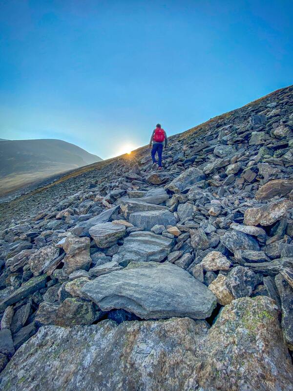
2. The weather can change drastically in little time. Thunderstorms and lighting are super common, especially around noon/mid day. Starting a hike early (like before sunrise...or even earlier for some of the fourteeners) is essential. You don't want to be above the tree line in a lightning storm. Even Breckenridge City is almost 10,000 feet. ...So just something to keep in mind. Hiking early is almost always essential here!
.... Colorado is beautiful! ENJOY!
BRECKENRIDGE (AREA)


Breckenridge
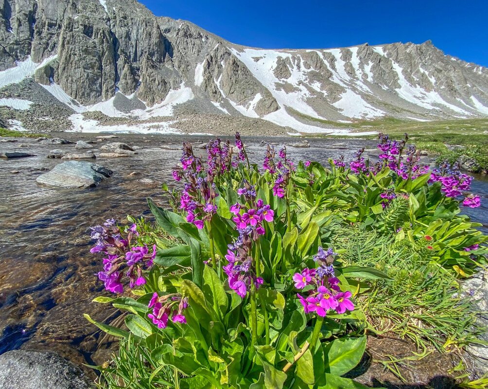
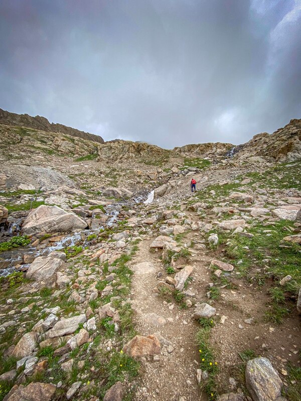
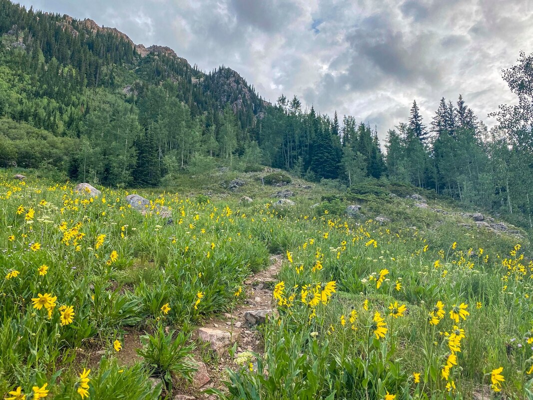
// MOHAWK LAKES / 5* / 8.4 MILES / 2,106 FT. GAIN / MODERATE / DOGS
Beautiful hike! Alpine lakes, flowers, views...it's got it all! I've heard this trail can get crowded so definitely recommend going on weekday if it's possible.
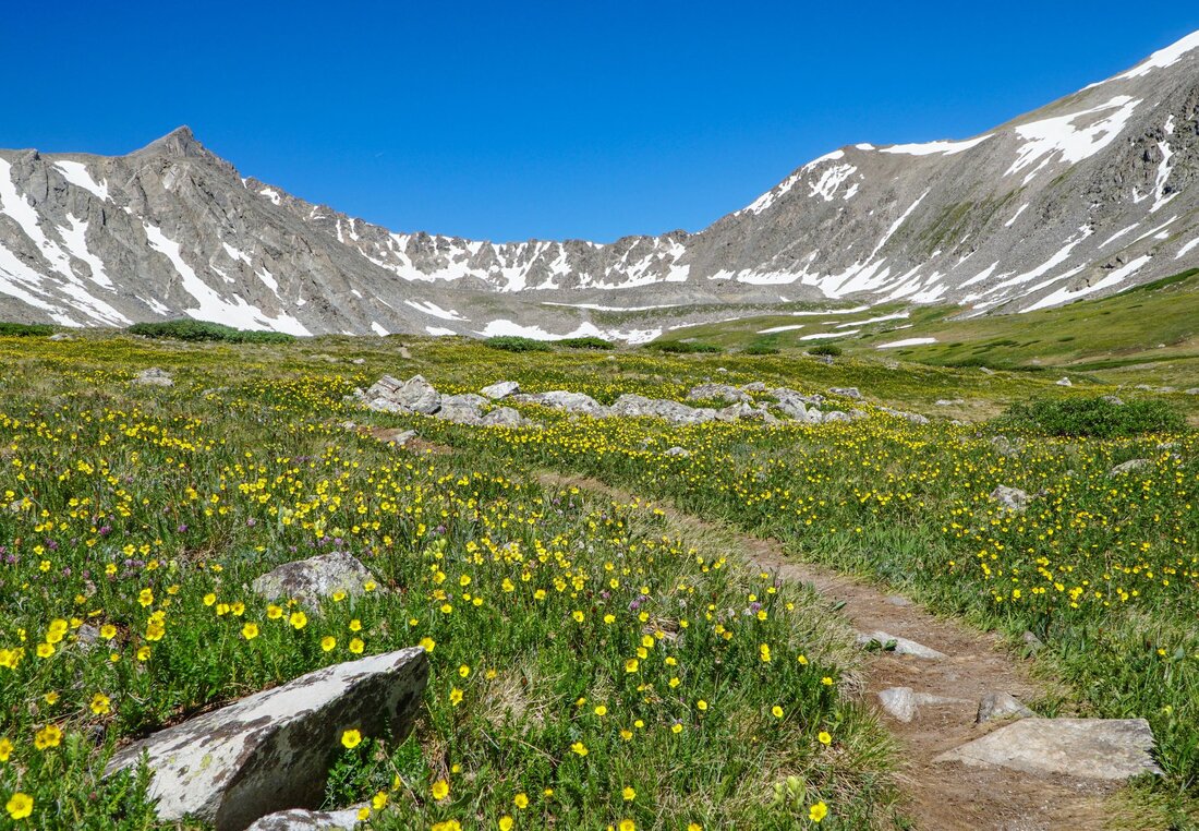
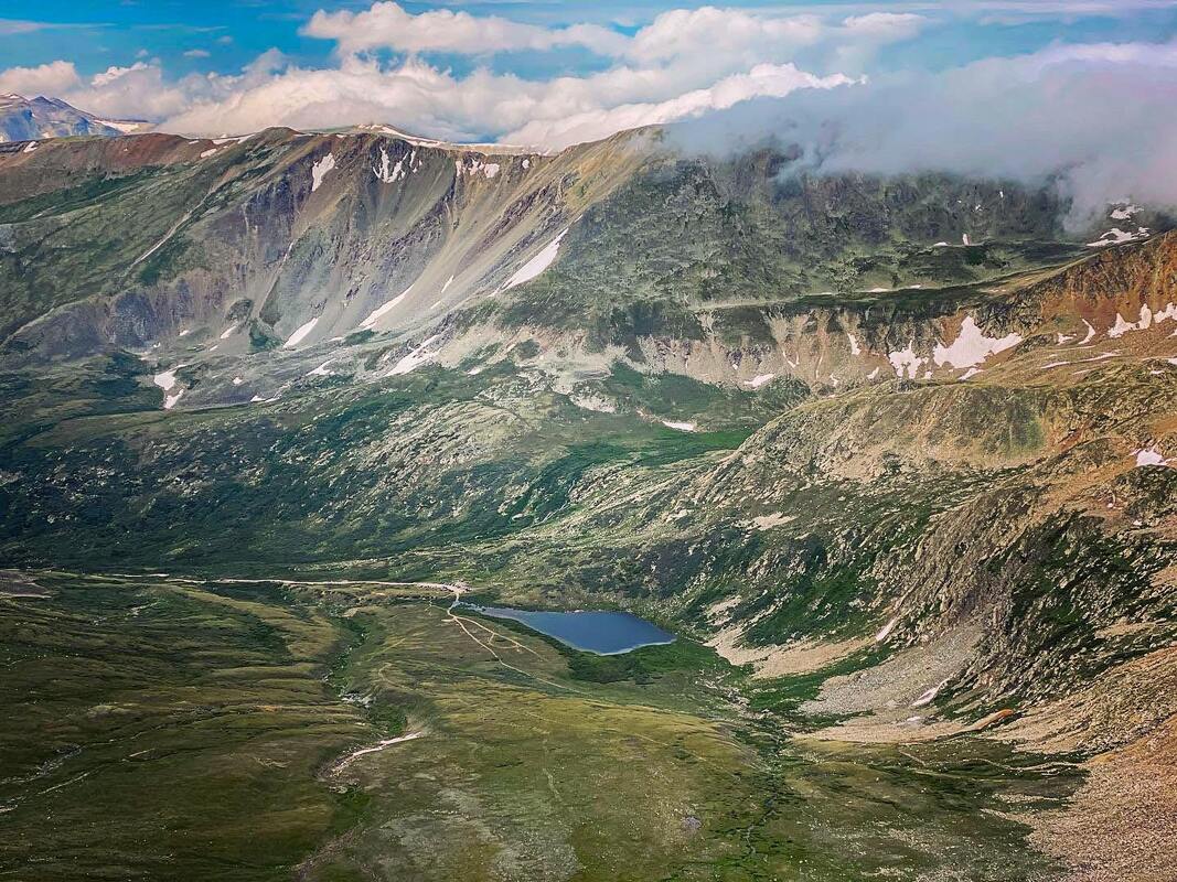
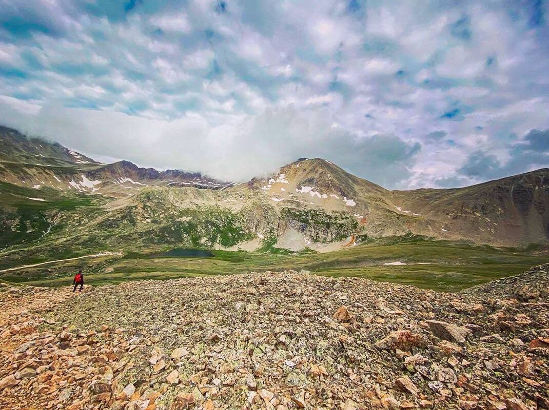
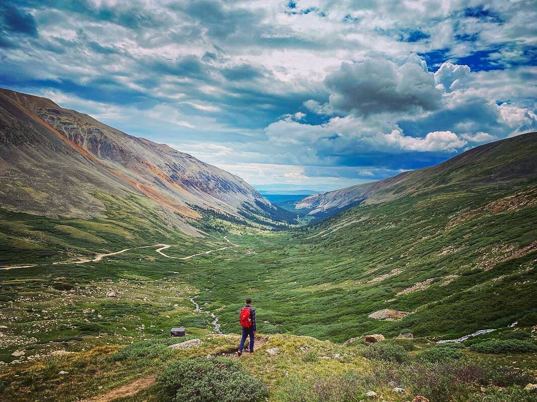
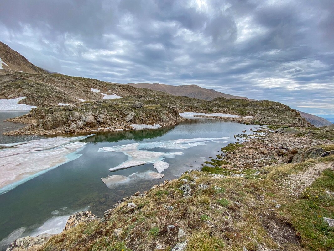
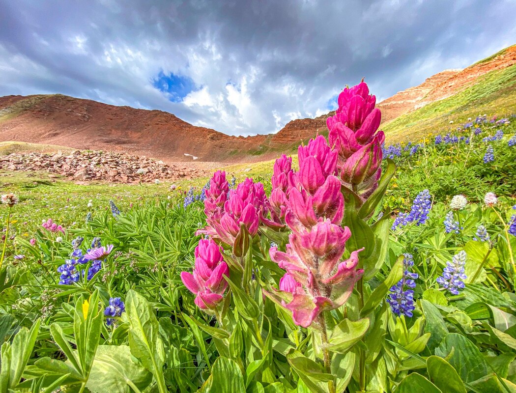
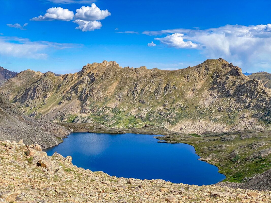
// MONTE CRISTO GULCH + BLUE LAKES / 5* / 2.8 MILES / 1,131 FT. GAIN / MODERATE - HARD / DOGS
This trail start from Blue Lakes, which in themselves are beautiful...And you can drive to them! If you want an EASY hike, you can just stick with the blue lakes themselves (aprox 1 mile?). If you are continuing on, the hike up to Monte Cristo Gulch is amazing! You will catch views, flowers, and an awesome alpine basin!...But you do gain quite a bit of elevation and end up at 13,000 ft. If you ask me, 100% worth it! Near the end you can scramble up the basin a bit,...or it is even possible to combine the hike with Quandary Peak (a 14-ER I didn't get to do...yet.). I'm pretty sure we did more than 2.8 miles when we did this hike, but thats what All-Trails says, so just going with that.
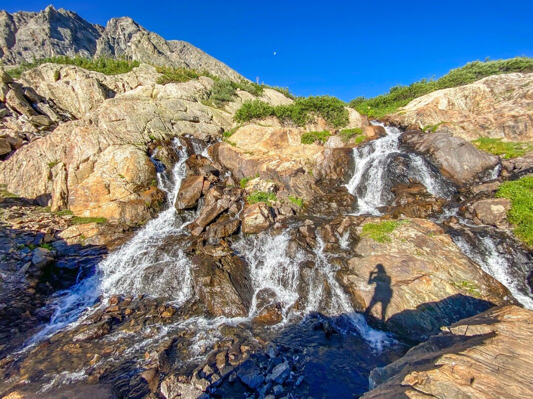
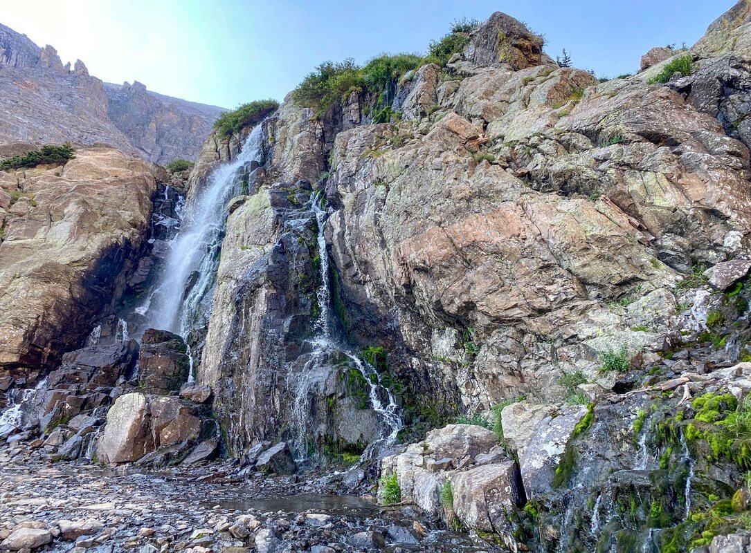
// MC CULLOUGH GULCH / 5* / 6.4 MILES / 1,607 FT. GAIN / MODERATE - HARD / DOGS
Such an awesome trail! Trail changes up to new scenery as you continue along. Forest, waterfalls, wild flowers, views, alpine - This trail has it all. One thing to note: The trailhead starts further down the road where the popular 14-er, Quandry Peak, starts. The road is a one lane, two direction road. I didn't have any problems, but it could be tricky if people are coming/leaving...or parking for the Quandry hike. Road good otherwise....And so close to Breck!
// HOOSIER PASS LOOP/ 3*-4* / 2.8 MILES / 688 FT. GAIN / EASY / DOGS
Nice views. Weather wasn't the best when we did this one. Nice that it was a loop, although part of the loop was a dirt road. Decent hike.
DOWNTOWN(ISH) BRECKENRIDGE AREA (There are many trails in town, but these were my favorite)
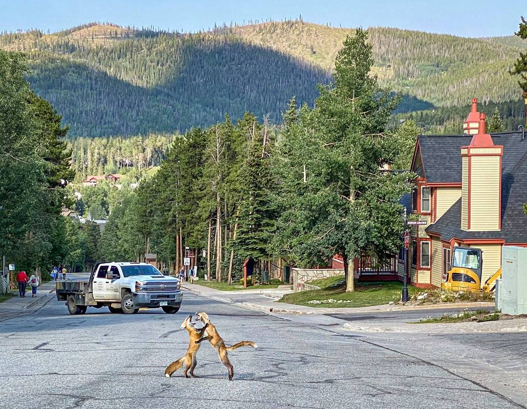
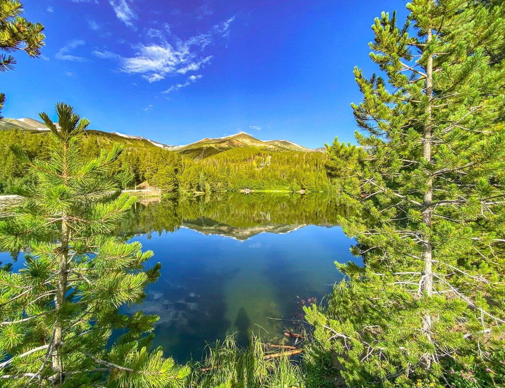
// SAWMILL RESERVOIR / 4* / 1 MILES (LOOP) / 236 FT. GAIN / EASY / DOGS
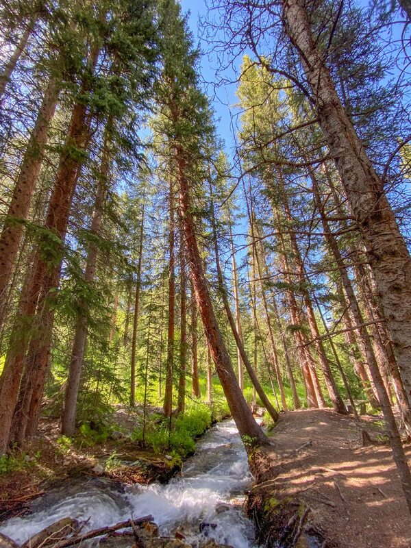
My favorite downtown-ish Breckenridge hike. You start by going up a pretty stream to arrive at the reservoir. The reservoir reflects the mountains around it and is very picturesque. Then you can loop back (if you want). I lived close to the trailhead and it was my go-to for a quick hike or trail run. Expect to possibly see wildlife. I saw some foxes run from the trailhead into the street to have a brawl. It was pretty cool to witness. Ive also heard moose frequent that area, although I never saw any on this hike.
// THE BRECKENRIDGE TROLL / 4* / ? MILES (SHORT) / ? FT. GAIN / EASY / DOGS
A must-do hike while visiting the town of Breckenridge. Close to downtown.
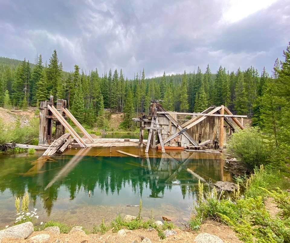
// MINNIE MINE LOOP / 3*-4* / 1.5 MILES / 209 FT. GAIN / EASY / DOGS
Nice trail to a gold mining dredge. Can make the trail shorter and a loop as I believe we did? If you are into history and seeing the old mine (and area) you will love this trail. Definitely an interesting area of Breck. Other than the mines, trail isn't too exciting though. Nice place to pass time and enjoyed the hike overall.
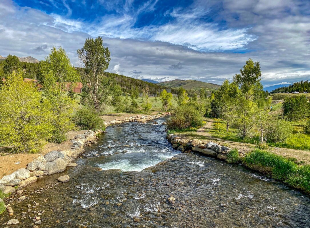
// BLUE RIVER BIKE TRAIL
An awesome paved path that connects Breckenridge to Frisco (and vice versa). 8.8 miles total. Can connect to other trails in Frisco. Paved, but some small dirt trails along the river near Breckenridge. Passes through nice parks. Used the trail with a bike and partially for a trail run. What a great trail!
// BOREAS PASS (SCENIC DRIVE)
Scenic drive with some optional hikes along the road. I didn't do much hiking, but definitely recommend the drive. It's a dirt road, but i'm pretty sure its ok for lower clearance 2-wheel drive.
// PEAK 9
I cheated and drove up this (need high clearance I think?). It is aprox. 6 miles and pretty steep. It was worth it as a drive. Nice views of the mountains. I don't think I would bother hiking it though?
ALMA
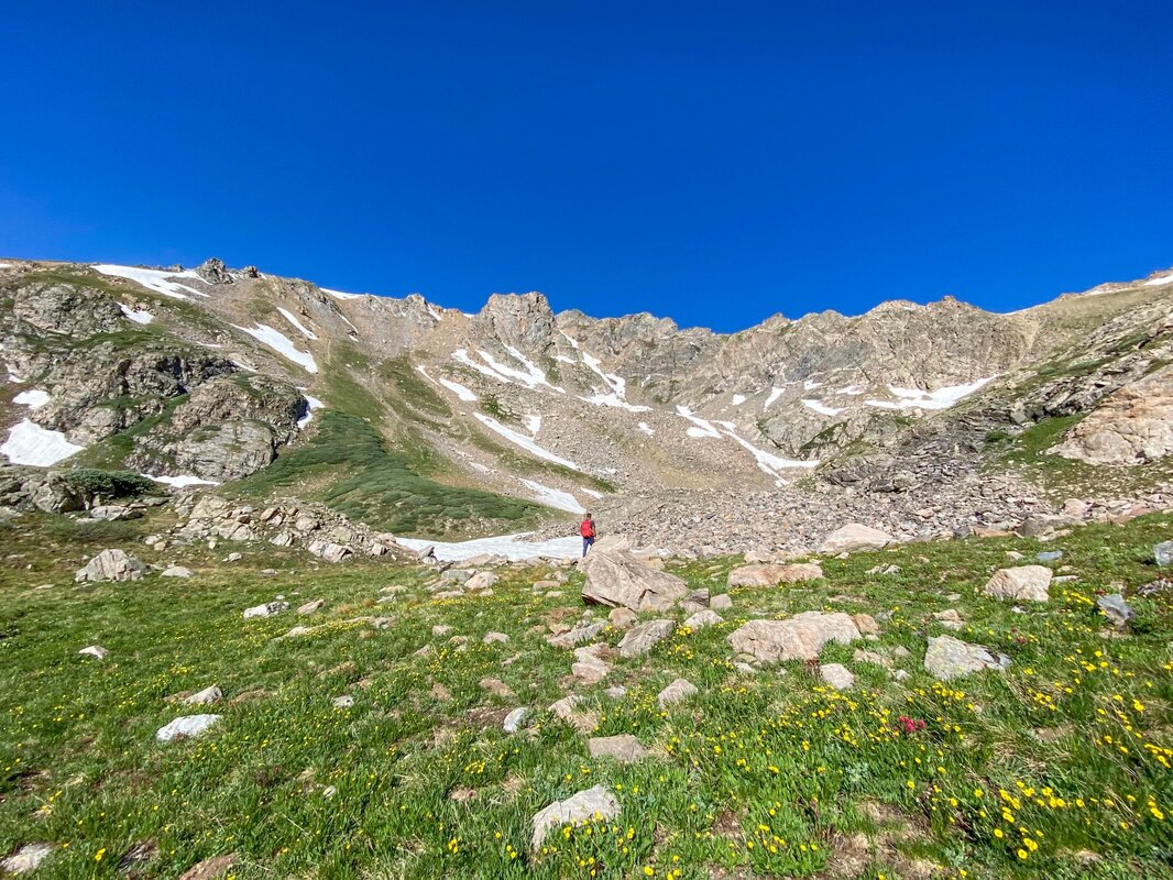
// THE DECALIBRON (+ LAKE EMMA) / 5* / 7 MILES / 3,136 FT. GAIN / HARD / DOGS /*14-ER (x 4)
The Decalibron is a hike that takes you to four 14-er's, Mt. Democrat, Cameron, Lincoln, and Bross. We did the hike clockwise which made for a steep decline on the last mountain (Bross), but I'm glad we went the way we did. Although we got some views on the climb up, the first 2 peaks were cloud covered at the top. The 3rd one had extreme fog but we started to get some peek-a-boos. By Mt. Bross, the fog had lifted, but just over Mt. Bross and the valley. The views were spectacular! For not seeing a lot most of the hike I still give it a 5*. It was that wowing! After completing this hike we did lake Emma, which also starts from the parking lot. So glad we did, it made for an amazing day! If you have the gusto, I say go! ...And start early!
// LAKE EMMA / 4* / 1.6 MILES / 629 FT. GAIN / MODERATE-HARD / DOGS?
So glad we decided to give this one a go! Wether you do this after the Decalibron or as a hike by itself, it's a nice one. For being a short hike, it is pretty much straight uphill, so take note it's not easy. However, the views are amazing behind you as you climb, and in front of you, a waterfall you meander up. At the top, finally, is lake Emma. When we were there there were icebergs floating in the water, which made it feel magical. I don't think my pictures did justice to the beauty of the lake.
FRISCO / KEYSTONE
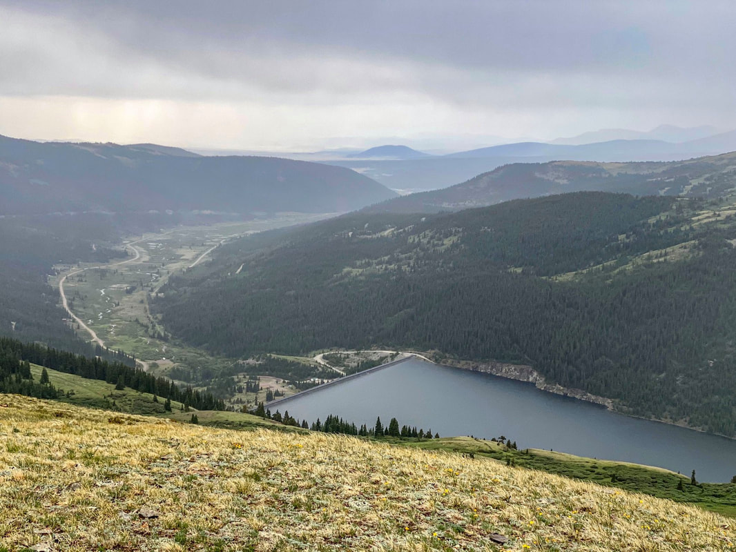
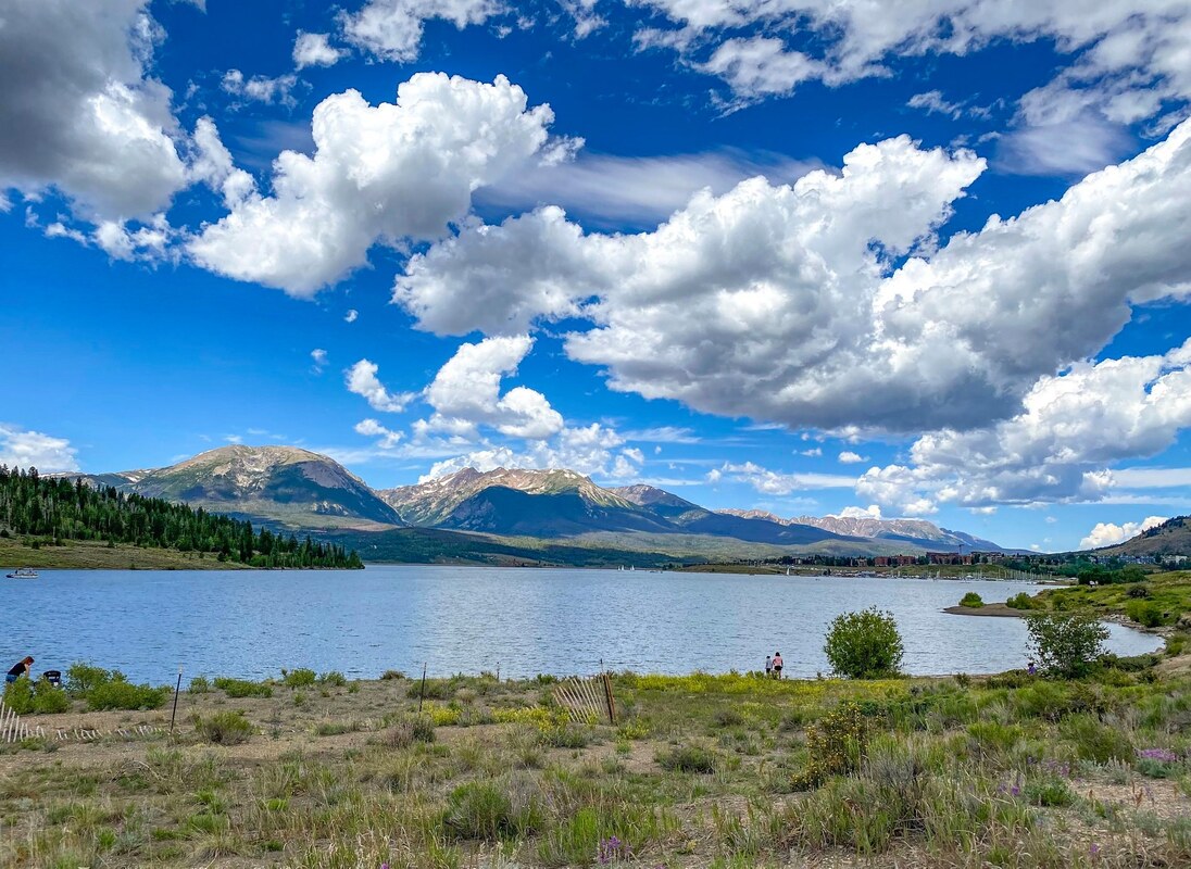
// DILLON RESERVOIR BIKE TRAIL
Nice paved trail that runs along the reservoir. Not the most exciting as a "hike", but makes a nice bike ride. Reservoir is nice. Stretches over 18 miles I think? Connects Frisco to Keystone (and vise-versa). Can also connect it with other trails. Pretty cool!
DILLON
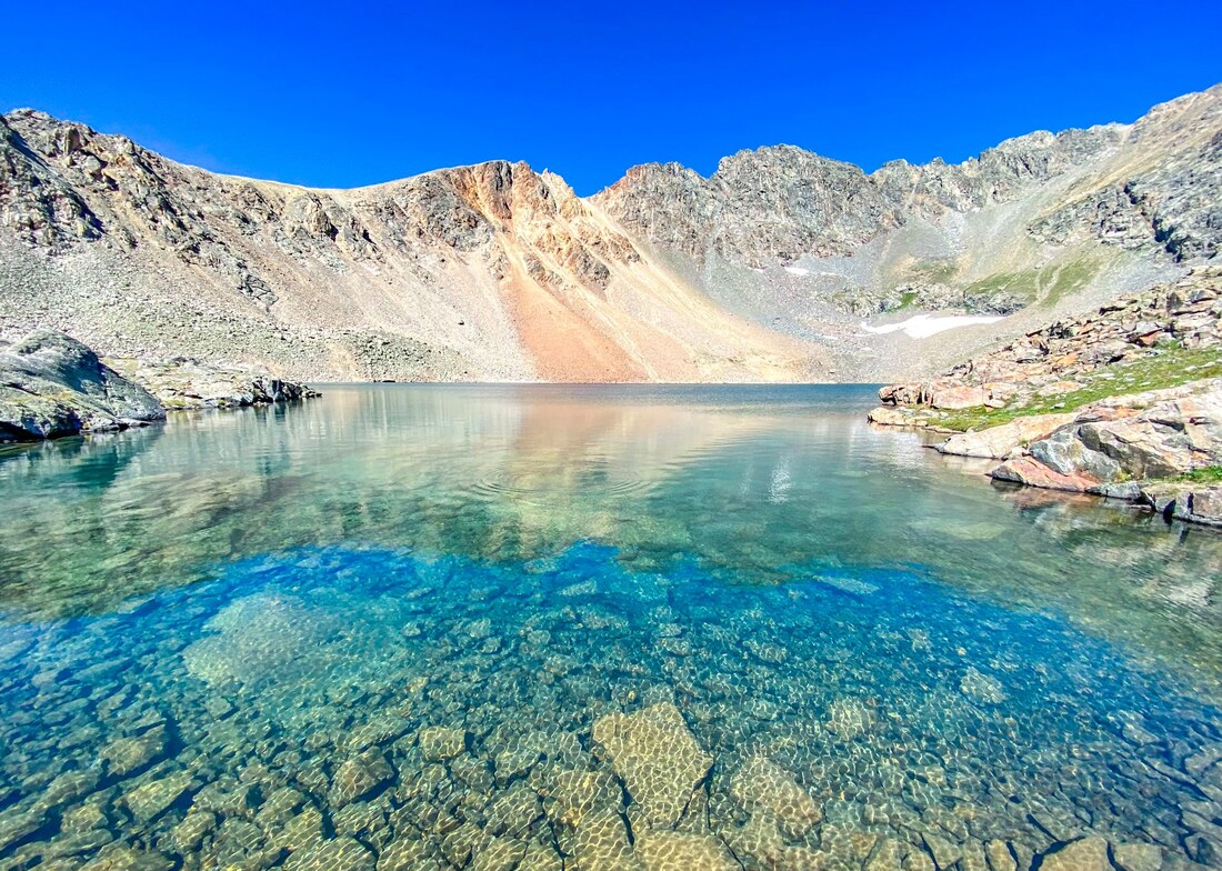
// CHIHUAHUA LAKE / 4* / 7.8 MILES / 1,879 FT. GAIN / MODERATE / DOGS
A super nice hike to a beautiful turquoise lake up in the alpine. Flowers , lakes, views....Recommend!
TERRYALL
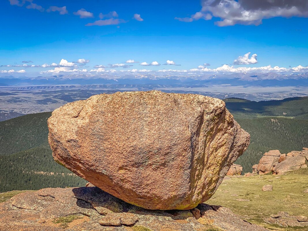
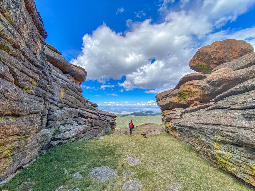
// BISON PEAK / 4*-5* / 11.8+? MILES / 3,736? FT. GAIN / DOGS
Terryall, where Bison Peak is located, is not really close to anything. But because I did this as a day trip from Breckenridge, i've included it in this section. This hike is all about exploring when you get to the top of the mountain so leave plenty of allotted time. At the top is where this hike becomes a super unique place, unlike any other hikes in Colorado (that I've done). Really cool boulders and rock shapes!...and views too! It was super fun roaming around and exploring all these rock formations. I really enjoyed this one!
ASPEN


MAROON BELLS
We really wanted to do the whole 25.7+ mile, 7,752 ft. gain, 4-pass loop of the Maroon Bells, but were day hiking and thought it might be better to break it up into 2 hikes, doing 2 of the 4 passes.
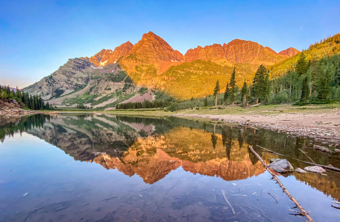
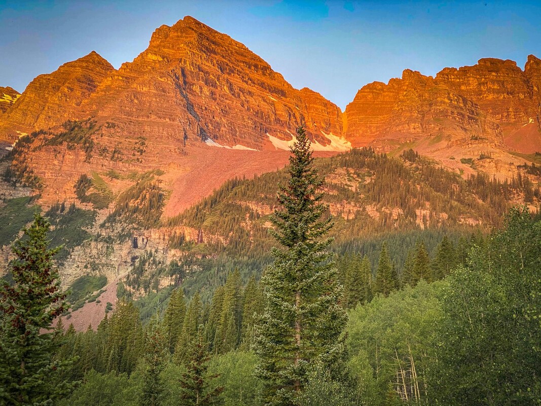
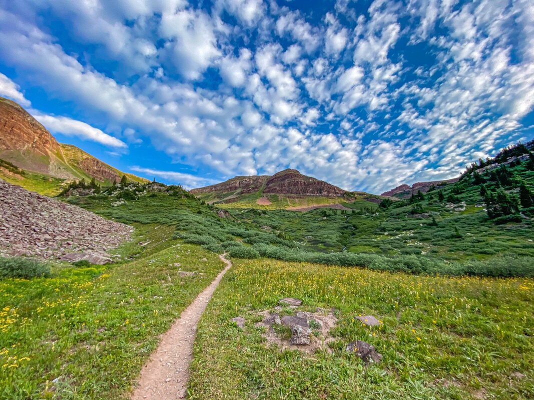
// CRATER LAKE + BUCKSKIN PASS + SNOWMASS LAKE / 5* / 20.3 MILES / 6,213 FT. GAIN / HARD / DOGS
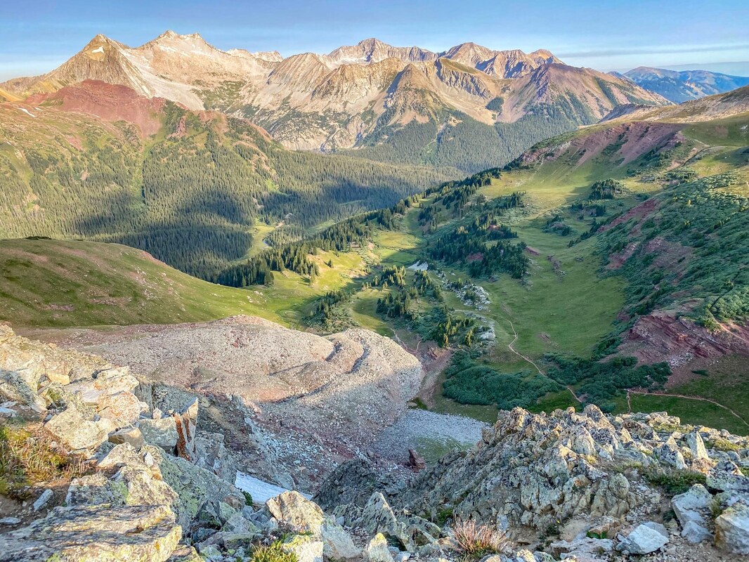
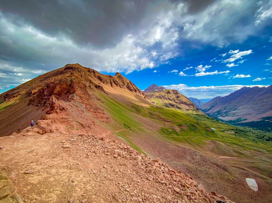
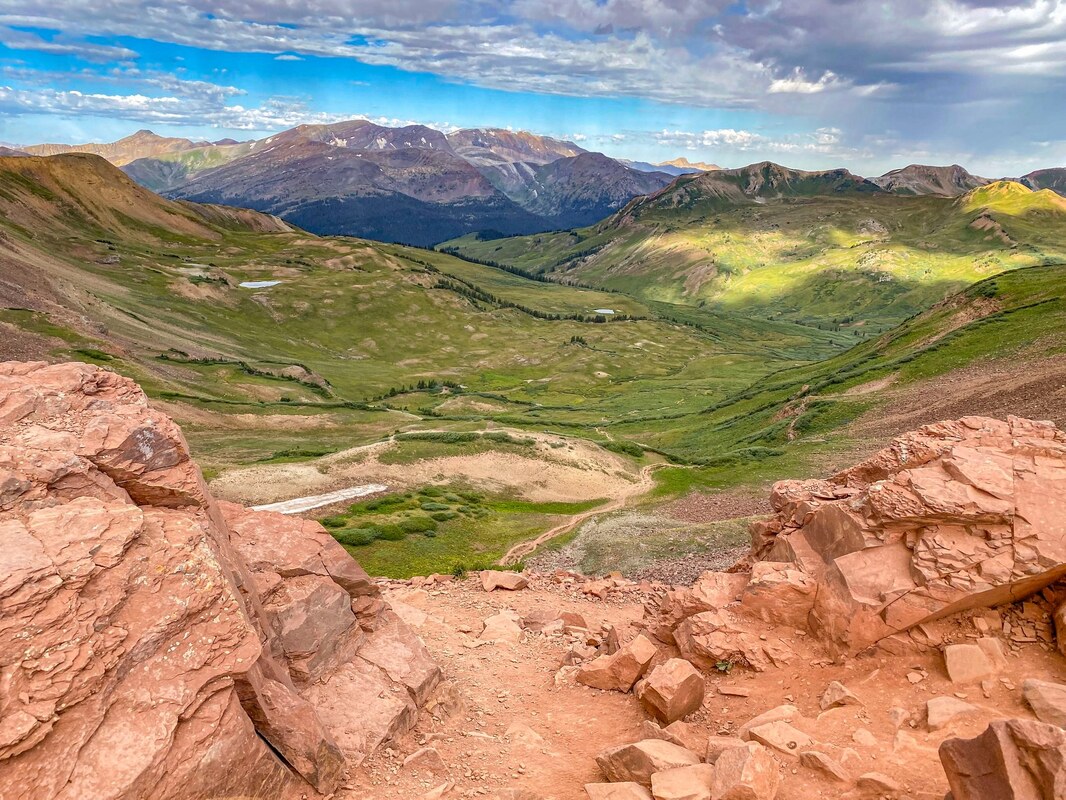
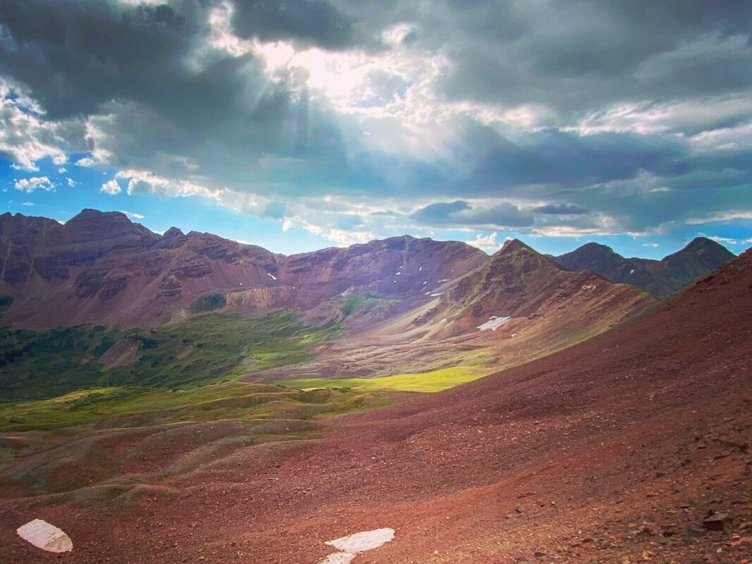
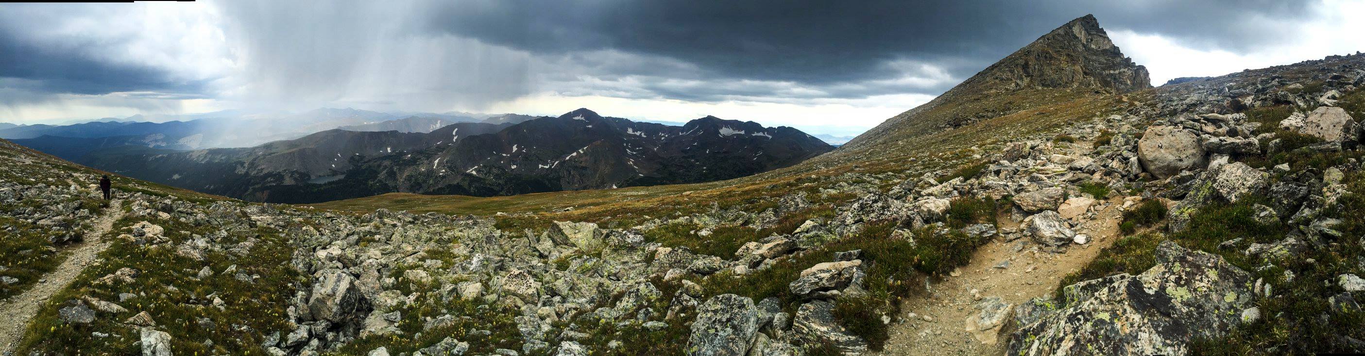
Wow! One of the most amazing hikes I've ever done! Started before sunrise and made it to Crater Lake for Sunrise. Highly recommend Crater lake at sunrise! So awesome with the rising sun turning the peaks red in color....and almost no one else around. If you go at sunset expect huge crowds, just fyi (and I didn't think it was as beautiful as sunrise). It's about 3.5 miles RT to Crater lake, if thats as far as you want to go....However, if you are up for it and carry on toward Buckskin Pass, you will be in awe the whole way...especially when you get to the pass. Yes, it's a good amount of elevation gain, but so amazing! If you want, you can then continue on. I went on to Snowmass Lake before turning back. Even after Buckskin Pass, the hike continued to be ever changing in beautiful and unique scenery. Awesome all the way! ( The panoramic photo at the top of this hiking page is Buckskin Pass)
// WEST MAROON PASS / 4-5* / 7.8 MILES / 2,165FT. GAIN / HARD / DOGS
Although I felt Buckskin Pass was more amazing than West Maroon Pass, West Maroon Pass was still beautiful! Amazing area and nice change-up of scenery the whole way. The overall hike was easier than Buckskin Pass, but note the last push up the pass is pretty intense.....but super cool! Like Buckskin Pass, we got to capture the sunrise over Crater Lake.
INDEPENDENCE PASS AREA
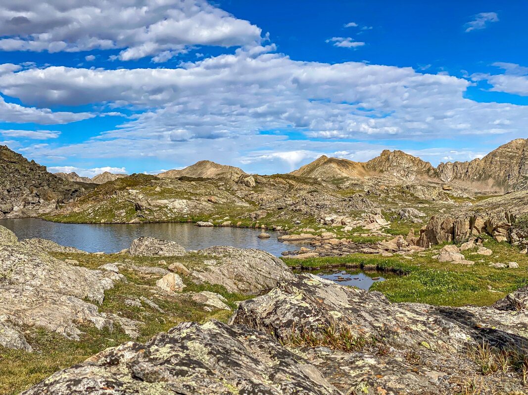
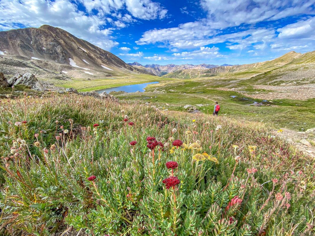
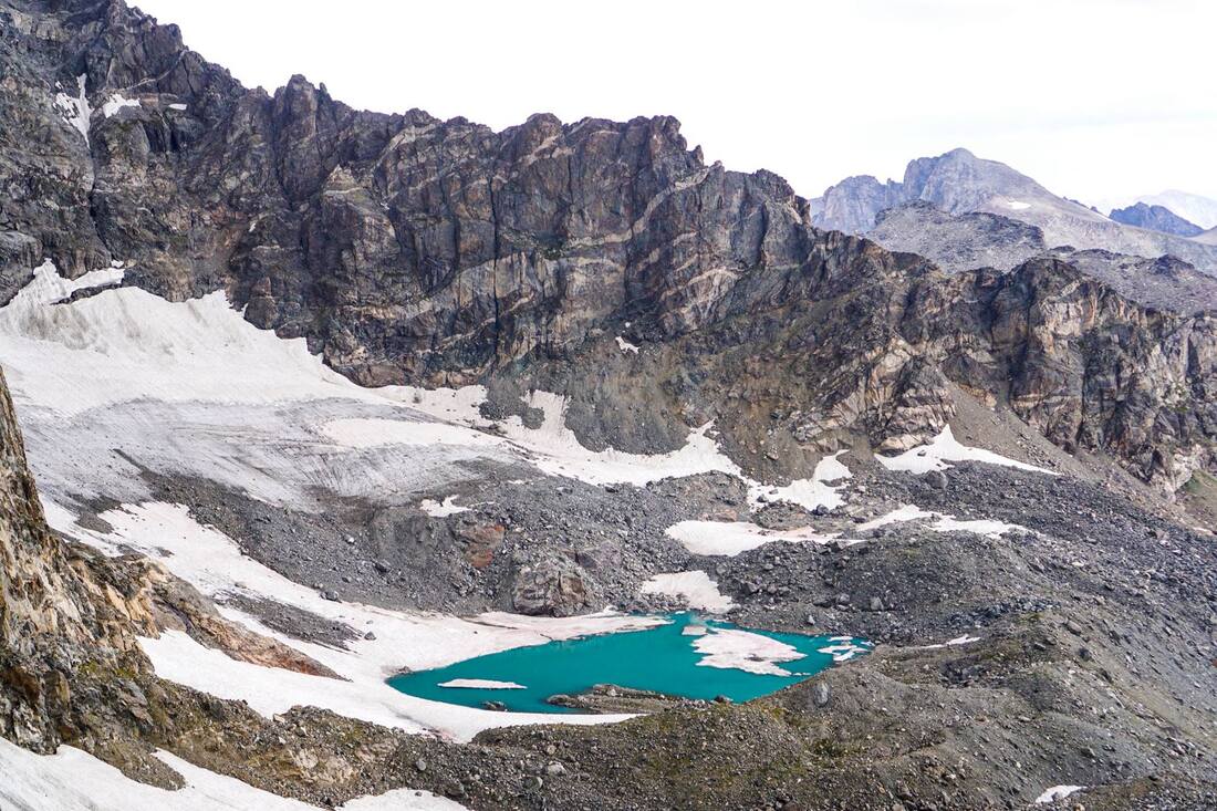
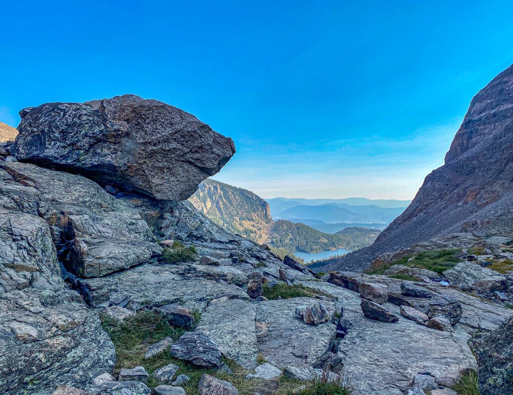
// LOST MAN LAKE / 4-5* / 5.5 - 8.7+ MILES / 1,387 - 1,601 FT. GAIN / MODERATE-HARD / DOGS
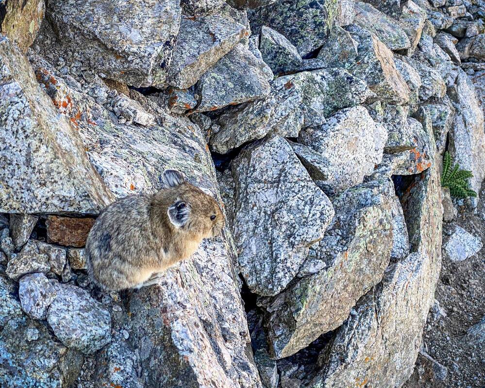
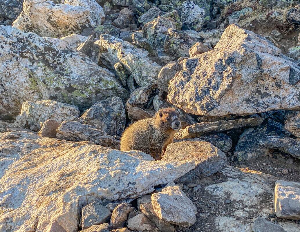
Beautiful area and lakes. I did the 8.7 mile sort-of loop. Leaving bikes at one end,- driving down to the other trailhead - and then riding the bike back to the car (down Independence Pass) at the end. It was fun for sure....but I must say the best scenery can be seen by just doing the out-and-back 5.5 mile hike. Either way, you will be good to go. Lost man lake is a striking cobalt blue! Independence lake is beautiful as well. Marmots, picas, wildflowers, and more.
WEST OF INDEPENDENCE PASS
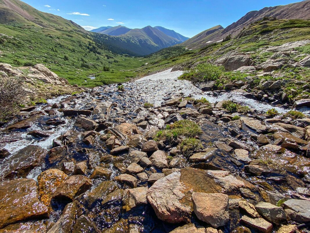
// LA PLATA PEAK / 5* / 9.6 MILES / 4,370 FT. GAIN / HARD / DOGS / 14-ER
Great trail with scenic variety! ...But yes, it's hard! Especially the last mile or so to reach the peak at over 14,00 ft. However, beautiful views reward you up top. Watching lots of picas carrying flowers away made the trail more fun as well as a marmot who poked up to say hi on the summit. The beginning of the trail was even nice with views of the peak and La Plata gulch. If you've got the gusto, highly recommend! I did this hike while staying in Breckenridge, but included it under Aspen as it is slightly closer to Aspen than Breck.
We really wanted to do the whole 25.7+ mile, 7,752 ft. gain, 4-pass loop of the Maroon Bells, but were day hiking and thought it might be better to break it up into 2 hikes, doing 2 of the 4 passes.
// CRATER LAKE + BUCKSKIN PASS + SNOWMASS LAKE / 5* / 20.3 MILES / 6,213 FT. GAIN / HARD / DOGS
Wow! One of the most amazing hikes I've ever done! Started before sunrise and made it to Crater Lake for Sunrise. Highly recommend Crater lake at sunrise! So awesome with the rising sun turning the peaks red in color....and almost no one else around. If you go at sunset expect huge crowds, just fyi (and I didn't think it was as beautiful as sunrise). It's about 3.5 miles RT to Crater lake, if thats as far as you want to go....However, if you are up for it and carry on toward Buckskin Pass, you will be in awe the whole way...especially when you get to the pass. Yes, it's a good amount of elevation gain, but so amazing! If you want, you can then continue on. I went on to Snowmass Lake before turning back. Even after Buckskin Pass, the hike continued to be ever changing in beautiful and unique scenery. Awesome all the way! ( The panoramic photo at the top of this hiking page is Buckskin Pass)
// WEST MAROON PASS / 4-5* / 7.8 MILES / 2,165FT. GAIN / HARD / DOGS
Although I felt Buckskin Pass was more amazing than West Maroon Pass, West Maroon Pass was still beautiful! Amazing area and nice change-up of scenery the whole way. The overall hike was easier than Buckskin Pass, but note the last push up the pass is pretty intense.....but super cool! Like Buckskin Pass, we got to capture the sunrise over Crater Lake.
INDEPENDENCE PASS AREA
// LOST MAN LAKE / 4-5* / 5.5 - 8.7+ MILES / 1,387 - 1,601 FT. GAIN / MODERATE-HARD / DOGS
Beautiful area and lakes. I did the 8.7 mile sort-of loop. Leaving bikes at one end,- driving down to the other trailhead - and then riding the bike back to the car (down Independence Pass) at the end. It was fun for sure....but I must say the best scenery can be seen by just doing the out-and-back 5.5 mile hike. Either way, you will be good to go. Lost man lake is a striking cobalt blue! Independence lake is beautiful as well. Marmots, picas, wildflowers, and more.
WEST OF INDEPENDENCE PASS
// LA PLATA PEAK / 5* / 9.6 MILES / 4,370 FT. GAIN / HARD / DOGS / 14-ER
Great trail with scenic variety! ...But yes, it's hard! Especially the last mile or so to reach the peak at over 14,00 ft. However, beautiful views reward you up top. Watching lots of picas carrying flowers away made the trail more fun as well as a marmot who poked up to say hi on the summit. The beginning of the trail was even nice with views of the peak and La Plata gulch. If you've got the gusto, highly recommend! I did this hike while staying in Breckenridge, but included it under Aspen as it is slightly closer to Aspen than Breck.
VAIL

// PITKIN LAKE + BOOTH LAKE (COMBINED HIKE) / 5* / 12? MILES / ? FT. GAIN / HARD / DOGS
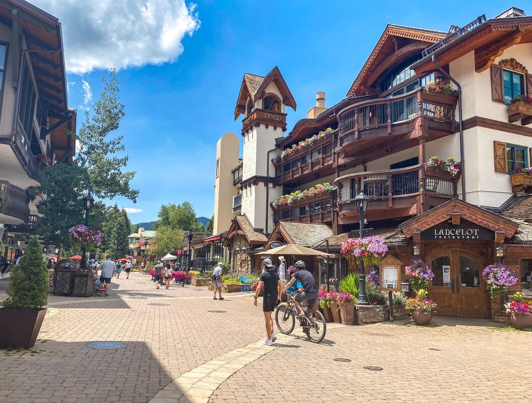
I'm having a hard time telling you to do this as a combined hike as I don't know if trampling up and down the pass that you can scramble to combine Pitkin to Booth is healthy for the land. It definitely is TRAMPLING up and down some steep terrain. However, by combining the hikes you get more of a loop hike, and you get to hike 2 amazing hikes in one. Definitely need GPS and some figuring where the pass is and how to maneuver up and down it, if you decide to combine. It is also an incredibly steep climb up and down, you have to way-find, and unfortunately probably not so good for the soil and plant matter you have to almost slide down. Would I do it again knowing that, probably not. Was it an epic adventure, yes. Think of it this way, if you do the hikes as individual hikes, you get 2 days of awesome adventures instead of 1. Preserving these places is most important. Note: VAIL VILLAGE is a great place to grab a bite or drink, stroll around, or relax after your hike.
// PITKIN LAKE / 4* / 10.5 MILES / 2,975 FT. GAIN / MODERATE - HARD / DOGS
This hike is nice the whole way. Variation of scenery starting with aspen trees, passing through meadows, creeks, and flowers, and ending at an alpine lake. I imagine the aspen section would be amazing in fall!
// BOOTH LAKE / 4*-5* / 10 MILES/ 3, 051 FT. GAIN / MODERATE - HARD / DOGS
An everything hike! Forest, waterfalls, vistas, meadows with flowers, and a big alpine lake at the end- awesome!...but definitely crowds, especially up to booth falls -so get an early start!
ARAPAHO NATIONAL FOREST


HIKES I TOOK WHILE STAYING IN BOULDER
// ARAPAHO GLACIER TRAIL / 5* / 8-10? MILES / 2,562 FT. GAIN / HARD / DOGS / ( NEAR NEDERLAND)
Amazing! The trail the whole way was fantastic! Views of lakes, wild flowers, and a beautiful glacier at the top! I did this trail the first time I went to Colorado the morning after I landed....possibly that is why it was hard? I'm not sure? But definitely felt the elevation. Also, didn't start hiking until 9am. Had to stop and turn around when we got to the glacier ( I remember the trail went slightly further?) because a thunderstorm came in. Went from wearing a tank top near the bottom to wearing my snow jacket and beanie (wish I had brought gloves) at the top when sky started to pummel hail on us. We booked it down as fast as we could to reach tree cover before the lightning showed up....Welcome to Colorado! Yes, this hike still gets 5*'s! Aprox. 1 hr. from Boulder.
HIKES I TOOK WHILE STAYING IN BRECKENRIDGE
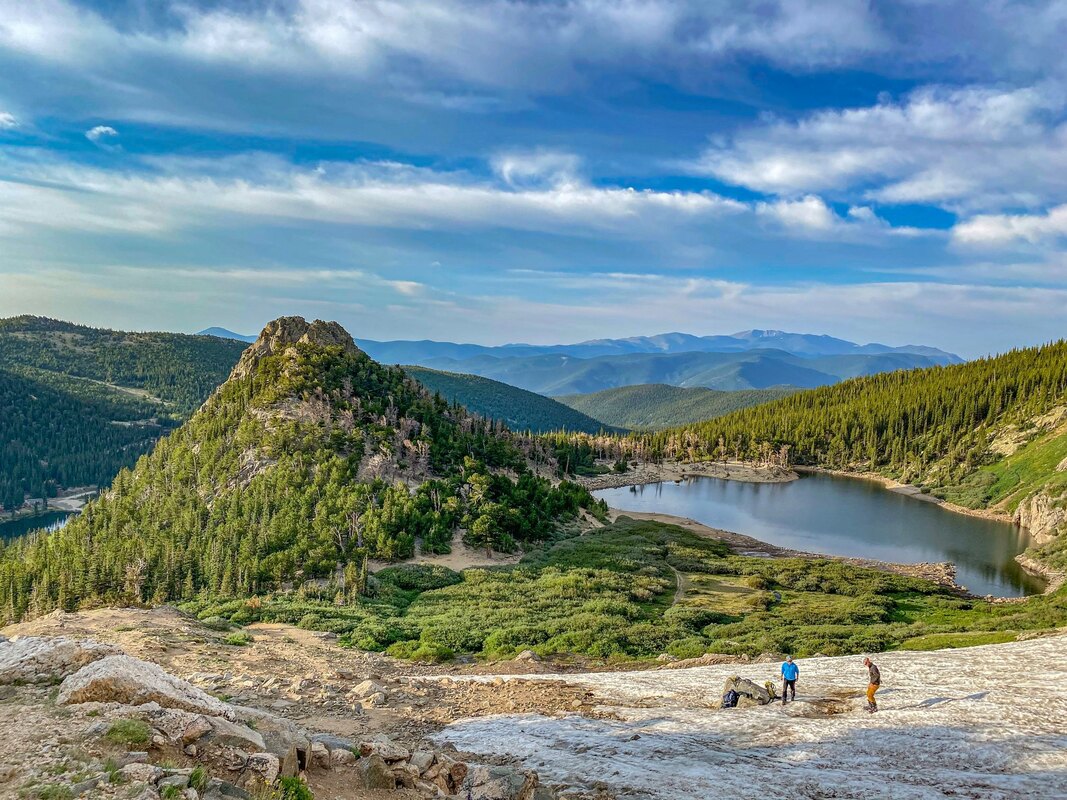
// CASCADE CREEK TRAILL / 5* / 16 MILES / 2,322 FT. GAIN / HARD / DOGS / ( NEAR GRANBY)
Such an awesome hike! It's a long one at 16 miles, but the trail the whole way was ever changing and beautiful. You start by making your way around Monarch lake. Along the way there are rivers and streams, a waterfall, meadows, forest, wildflowers, rocky areas...it keeps changing. We even saw a male moose....which was both exciting and scary at the same time. Luckily we were far enough distance to continue walking on the trail, but it definitely noticed and kept an eye on us as we meandered by. Then, finally at the end you reach the final two lakes, Mirror and Crater Lake, which are stunning and have these huge gothic - like peaks above them. Because of the distance, we camped at Arapaho Bay campground the night before and got an early start the next day( around sunrise ). Aprox. 2hrs from Breckenridge (Aprox 2 hrs. 15 minutes from Denver, 2 hrs. 30 minutes from Boulder)
// ST. MARY'S GLACIER / 4* / 2.4 MILES / 1,030 FT. GAIN / MODERATE / DOGS ( ST. MARY'S)
Very pretty lake and cool glacier. Didn't have the equipment to actually hike up the glacier, but did take a side trail up that offered beautiful views of the lake and glacier. Trail was rocky in the first part but overall, not too hard and relatively short - Almost wish it was longer. Aprox. 1 hr. 15min from Breckenridge. (Aprox. 1 hr. from Denver, 1hr. 15 min from Boulder)
// HERMAN GULCH / 4* / 7.2MILES / 1,774 FT. GAIN / MODERATE / DOGS ( NEAR LOVELAND SKI AREA / SILVER PLUME)
Although not at the top of my list (low 4*), this was a nice trail. Lots of wildflowers, the lake was nice, as well as sweeping views through the valley. We even extended the hike a little past the lake until the trails began to die out. Not too hard of a hike, but it got super busy. Especially if you go on a weekend, (which I believe we did ) early start recommended. Aprox. 40 minutes from Breckenridge.
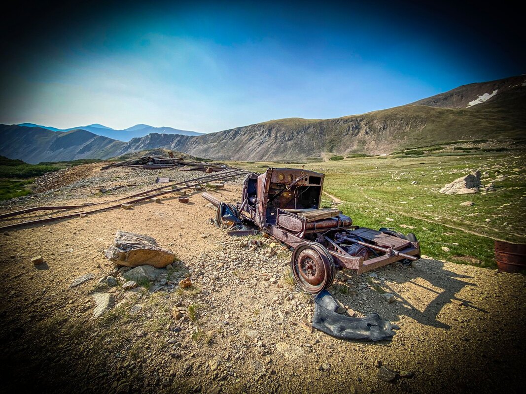
// BUTLER GULCH / 4* / 5.5 MILES / 1,811 FT. GAIN / MODERATE / DOGS ( NEAR EMPIRE)
I really enjoyed the Butler Gulch hike. Although it isn't up there with the best hikes I did in Colorado, I thought it was a nice hike overall. The scenery changes up along the hike and you get to go through forest, see a waterfall, take in views, and experience the remains of an old rail car and mine. When I did this hike in late July/ early August(?), there were tons of wildflowers around. We even sat and ate our lunch among them.
// SQUARE TOP MOUNTAIN / 3-4* / 7+MILES? / ?2,454FT. GAIN / HARD / DOGS (NEAR GEORGETOWN)
At 13,783 ft, for some reason, reaching the summit felt harder than any 14-ER I've done so far. And it's only 7 miles RT. Maybe I was just tired that day? Or could it have been the quickness we did the climb? (My husbands "Strava" said we were the second fastest ever recorded on "Strava" ) ...But false summit after false summit, it went straight up with no let up until finally reaching a rocky summit. The views up top were nice, and there were all these cool sparkling rocks, but would I do this hike again....No thank you very much! Was it worth doing once, maybe. Better than doing no hike at all. The scenery in this area is definitely nice, but a little on the drier side than other areas. Truthfully, this hike was closer to a 4*, than a 3*, and I did actually enjoy it overall, We even took a small detour to the lakes to have lunch. But, overall, I would say it isn't AS AMAZING as some of the other Colorado peaks I've done. But thats just my opinion. Aprox 1hr. 30 min from Breckenridge (Aprox. 1hr 40 min from Denver.)
// ARAPAHO GLACIER TRAIL / 5* / 8-10? MILES / 2,562 FT. GAIN / HARD / DOGS / ( NEAR NEDERLAND)
Amazing! The trail the whole way was fantastic! Views of lakes, wild flowers, and a beautiful glacier at the top! I did this trail the first time I went to Colorado the morning after I landed....possibly that is why it was hard? I'm not sure? But definitely felt the elevation. Also, didn't start hiking until 9am. Had to stop and turn around when we got to the glacier ( I remember the trail went slightly further?) because a thunderstorm came in. Went from wearing a tank top near the bottom to wearing my snow jacket and beanie (wish I had brought gloves) at the top when sky started to pummel hail on us. We booked it down as fast as we could to reach tree cover before the lightning showed up....Welcome to Colorado! Yes, this hike still gets 5*'s! Aprox. 1 hr. from Boulder.
HIKES I TOOK WHILE STAYING IN BRECKENRIDGE
// CASCADE CREEK TRAILL / 5* / 16 MILES / 2,322 FT. GAIN / HARD / DOGS / ( NEAR GRANBY)
Such an awesome hike! It's a long one at 16 miles, but the trail the whole way was ever changing and beautiful. You start by making your way around Monarch lake. Along the way there are rivers and streams, a waterfall, meadows, forest, wildflowers, rocky areas...it keeps changing. We even saw a male moose....which was both exciting and scary at the same time. Luckily we were far enough distance to continue walking on the trail, but it definitely noticed and kept an eye on us as we meandered by. Then, finally at the end you reach the final two lakes, Mirror and Crater Lake, which are stunning and have these huge gothic - like peaks above them. Because of the distance, we camped at Arapaho Bay campground the night before and got an early start the next day( around sunrise ). Aprox. 2hrs from Breckenridge (Aprox 2 hrs. 15 minutes from Denver, 2 hrs. 30 minutes from Boulder)
// ST. MARY'S GLACIER / 4* / 2.4 MILES / 1,030 FT. GAIN / MODERATE / DOGS ( ST. MARY'S)
Very pretty lake and cool glacier. Didn't have the equipment to actually hike up the glacier, but did take a side trail up that offered beautiful views of the lake and glacier. Trail was rocky in the first part but overall, not too hard and relatively short - Almost wish it was longer. Aprox. 1 hr. 15min from Breckenridge. (Aprox. 1 hr. from Denver, 1hr. 15 min from Boulder)
// HERMAN GULCH / 4* / 7.2MILES / 1,774 FT. GAIN / MODERATE / DOGS ( NEAR LOVELAND SKI AREA / SILVER PLUME)
Although not at the top of my list (low 4*), this was a nice trail. Lots of wildflowers, the lake was nice, as well as sweeping views through the valley. We even extended the hike a little past the lake until the trails began to die out. Not too hard of a hike, but it got super busy. Especially if you go on a weekend, (which I believe we did ) early start recommended. Aprox. 40 minutes from Breckenridge.
// BUTLER GULCH / 4* / 5.5 MILES / 1,811 FT. GAIN / MODERATE / DOGS ( NEAR EMPIRE)
I really enjoyed the Butler Gulch hike. Although it isn't up there with the best hikes I did in Colorado, I thought it was a nice hike overall. The scenery changes up along the hike and you get to go through forest, see a waterfall, take in views, and experience the remains of an old rail car and mine. When I did this hike in late July/ early August(?), there were tons of wildflowers around. We even sat and ate our lunch among them.
// SQUARE TOP MOUNTAIN / 3-4* / 7+MILES? / ?2,454FT. GAIN / HARD / DOGS (NEAR GEORGETOWN)
At 13,783 ft, for some reason, reaching the summit felt harder than any 14-ER I've done so far. And it's only 7 miles RT. Maybe I was just tired that day? Or could it have been the quickness we did the climb? (My husbands "Strava" said we were the second fastest ever recorded on "Strava" ) ...But false summit after false summit, it went straight up with no let up until finally reaching a rocky summit. The views up top were nice, and there were all these cool sparkling rocks, but would I do this hike again....No thank you very much! Was it worth doing once, maybe. Better than doing no hike at all. The scenery in this area is definitely nice, but a little on the drier side than other areas. Truthfully, this hike was closer to a 4*, than a 3*, and I did actually enjoy it overall, We even took a small detour to the lakes to have lunch. But, overall, I would say it isn't AS AMAZING as some of the other Colorado peaks I've done. But thats just my opinion. Aprox 1hr. 30 min from Breckenridge (Aprox. 1hr 40 min from Denver.)
BOULDER / DENVER / COLORADO SPRINGS


Boulder
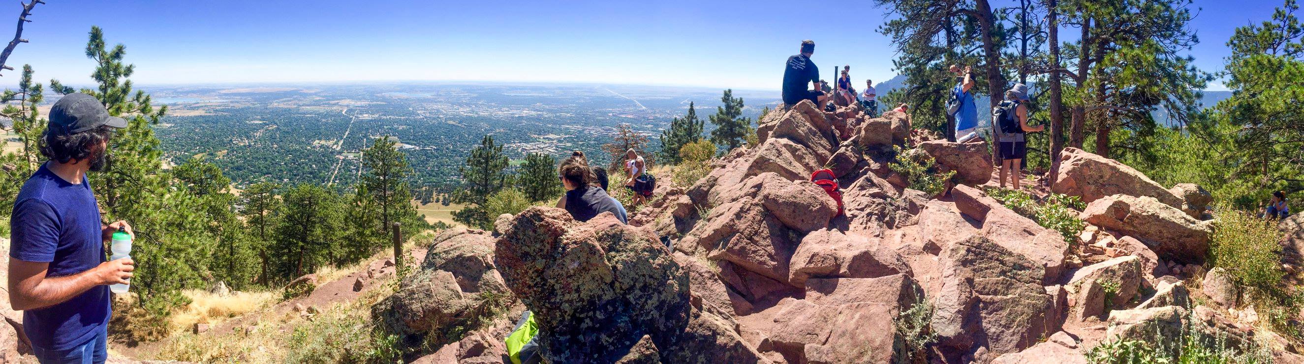
// MT. SANITAS / 3-4* / 2.6 / 1,259 FT. GAIN / MODERATE / DOGS
Nice views at the top, Steep hike up and down. Fun and quick hike in Boulder.
// THE FLATIRONS / 3-4* / ? MILES/ ? FT. GAIN / MODERATE / DOGS
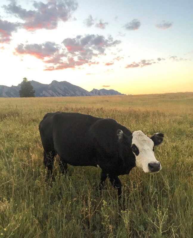
I'm not sure what trail I did here? It was a loop....It was a long time ago, haha. What I do remember....The sun set as we were ending out the trail, which was nice, especially with the flatirons in the background. Also, passed through lots of cows, which was fun. The overall trail was decent, but not wowing ...but still enjoyed it!
Denver
// DENVER BIKE TRAIL
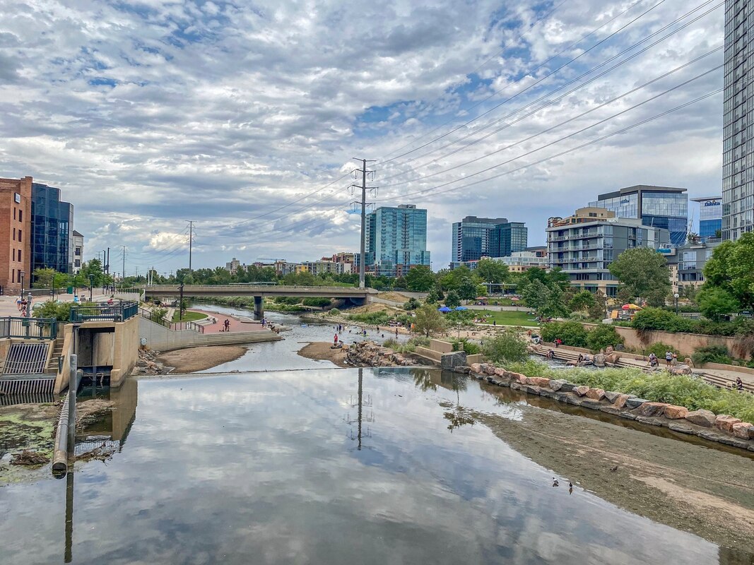
Although I really didn't do any hiking in Denver, I do have to say Denver has nice bike/walk ways throughout the city that extend to many different areas of the city. There is even an area along the path where you can swim/go tubing in the river (same with Boulder, btw). I also recommend Denver for it's great breweries (if you are into beer), many assessable from these pathways.
// RED ROCK AMPHITHEATER / 4* / 0-6MILES? / ? FT. GAIN / MODERATE / DOGS
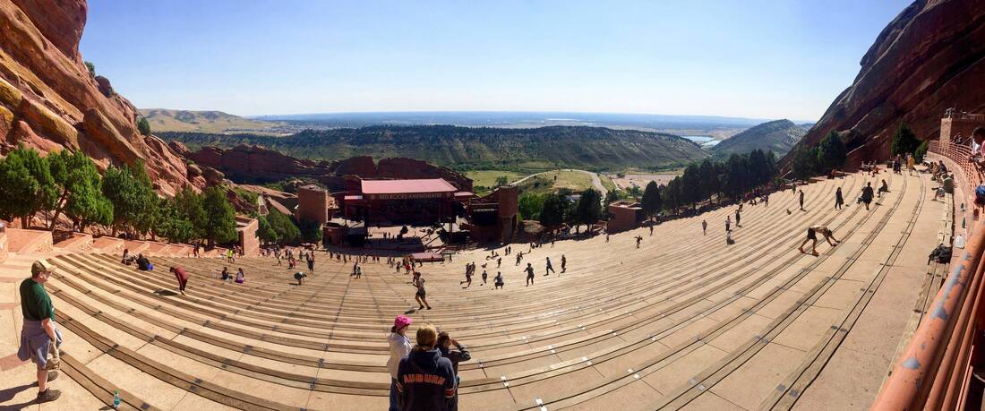
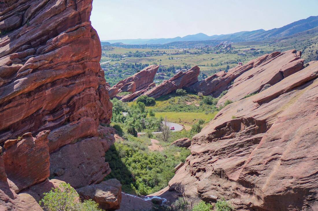
Red Rocks amphitheater is a truly unique place. I haven't gotten to experience a concert there yet, but it seems like an amazing place to see a show! Go there on a weekend day (or maybe any day?) and you will see a ton of people using the seating area for exercising -Like running up and down the stairs, jumping up on the seats, doing push up, etc. I don't know how to explain it well, but it's a sight to see (or join in for yourself). If you want to do a hike, there are also some trails (you can do a loop hike) surrounding the amphitheater. Its a really cool area with interesting rock formations. A must visit place!
Colorado Springs
I didn't explore Colorado Springs city too much, however nearby attractions were really nice and definitely recommend checking them out!
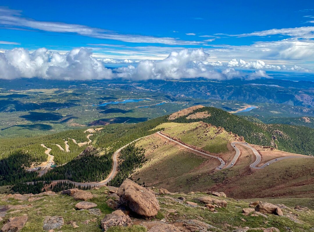
First there is // PILES PEAK, which I believe you can hike all the way up to this 14-ER?....but I took the easy way and just drove and took a shuttle to the top. It was definitely busy up there! ..And a lot of traffic going up and down. I would recommend going during the week if you can. Also very steep. So much I had to pull over and give my breaks a rest part way down (they check your brakes). Also there is a fee to drive up, fyi - Its not free. It's a tourist attraction, but worth seeing once. Really beautiful up there! There is actually a small hike in the area where you park to take the shuttle to the top. Views from there were amazing! We did shuttle to the top, but those views were unfortunately cloud covered that day.
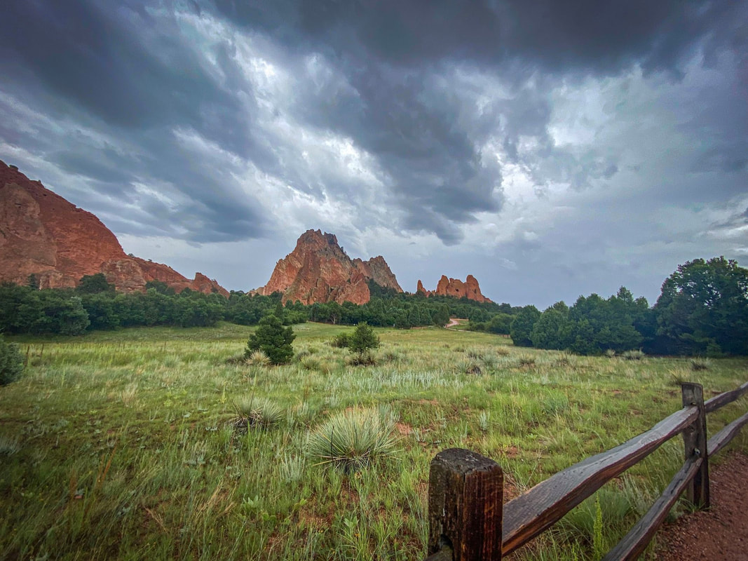
In addition to Piles Peak, there is // GARDEN OF THE GODS near Colorado Springs. There is a short loop hike through the park I recommend through and around the red-rock formations. Some mule deer even came down near the trail. Really enjoyed this place...and it is free! A must visit if you are in the area!
// MT. SANITAS / 3-4* / 2.6 / 1,259 FT. GAIN / MODERATE / DOGS
Nice views at the top, Steep hike up and down. Fun and quick hike in Boulder.
// THE FLATIRONS / 3-4* / ? MILES/ ? FT. GAIN / MODERATE / DOGS
I'm not sure what trail I did here? It was a loop....It was a long time ago, haha. What I do remember....The sun set as we were ending out the trail, which was nice, especially with the flatirons in the background. Also, passed through lots of cows, which was fun. The overall trail was decent, but not wowing ...but still enjoyed it!
Denver
// DENVER BIKE TRAIL
Although I really didn't do any hiking in Denver, I do have to say Denver has nice bike/walk ways throughout the city that extend to many different areas of the city. There is even an area along the path where you can swim/go tubing in the river (same with Boulder, btw). I also recommend Denver for it's great breweries (if you are into beer), many assessable from these pathways.
// RED ROCK AMPHITHEATER / 4* / 0-6MILES? / ? FT. GAIN / MODERATE / DOGS
Red Rocks amphitheater is a truly unique place. I haven't gotten to experience a concert there yet, but it seems like an amazing place to see a show! Go there on a weekend day (or maybe any day?) and you will see a ton of people using the seating area for exercising -Like running up and down the stairs, jumping up on the seats, doing push up, etc. I don't know how to explain it well, but it's a sight to see (or join in for yourself). If you want to do a hike, there are also some trails (you can do a loop hike) surrounding the amphitheater. Its a really cool area with interesting rock formations. A must visit place!
Colorado Springs
I didn't explore Colorado Springs city too much, however nearby attractions were really nice and definitely recommend checking them out!
First there is // PILES PEAK, which I believe you can hike all the way up to this 14-ER?....but I took the easy way and just drove and took a shuttle to the top. It was definitely busy up there! ..And a lot of traffic going up and down. I would recommend going during the week if you can. Also very steep. So much I had to pull over and give my breaks a rest part way down (they check your brakes). Also there is a fee to drive up, fyi - Its not free. It's a tourist attraction, but worth seeing once. Really beautiful up there! There is actually a small hike in the area where you park to take the shuttle to the top. Views from there were amazing! We did shuttle to the top, but those views were unfortunately cloud covered that day.
In addition to Piles Peak, there is // GARDEN OF THE GODS near Colorado Springs. There is a short loop hike through the park I recommend through and around the red-rock formations. Some mule deer even came down near the trail. Really enjoyed this place...and it is free! A must visit if you are in the area!
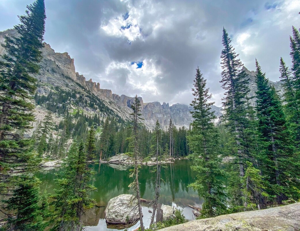
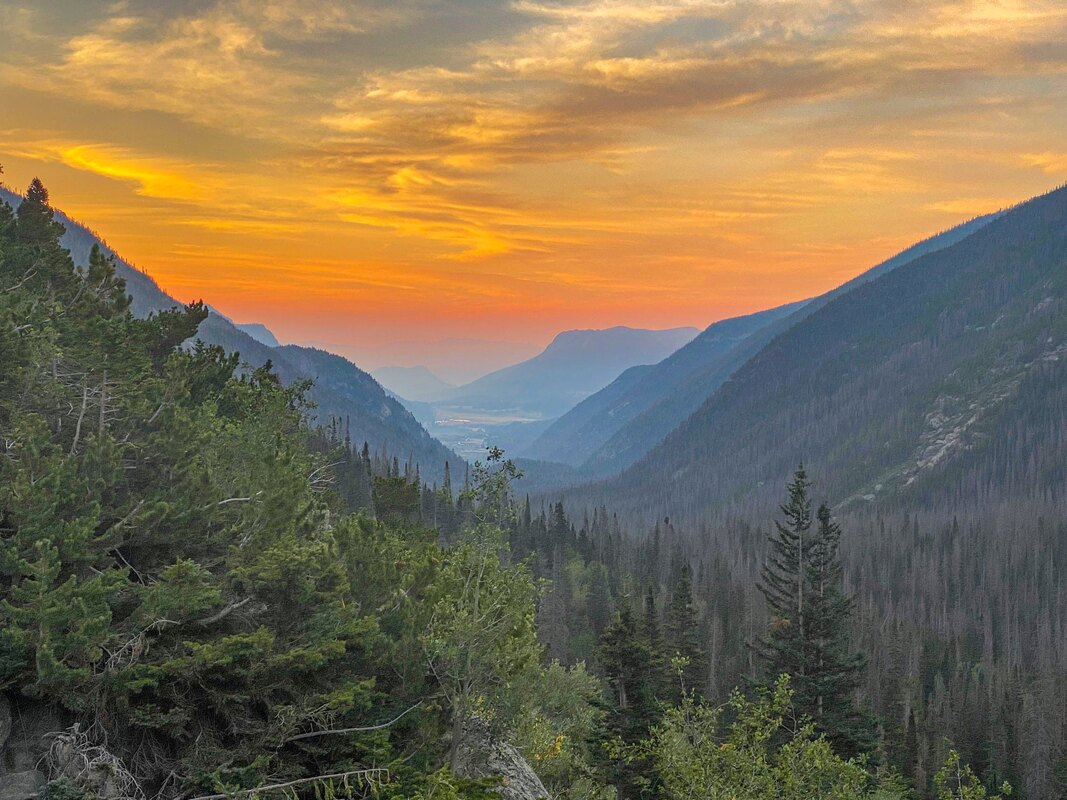
ROCKY MT NATIONAL PARK

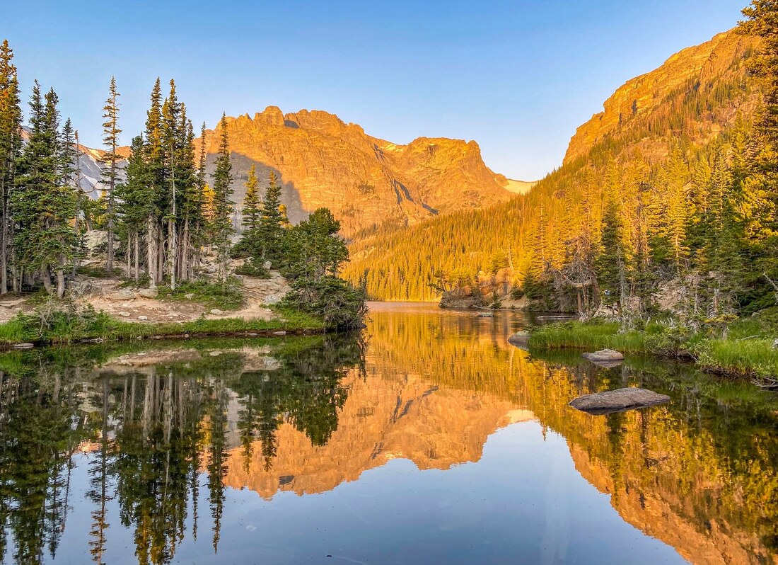
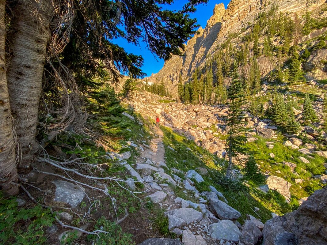
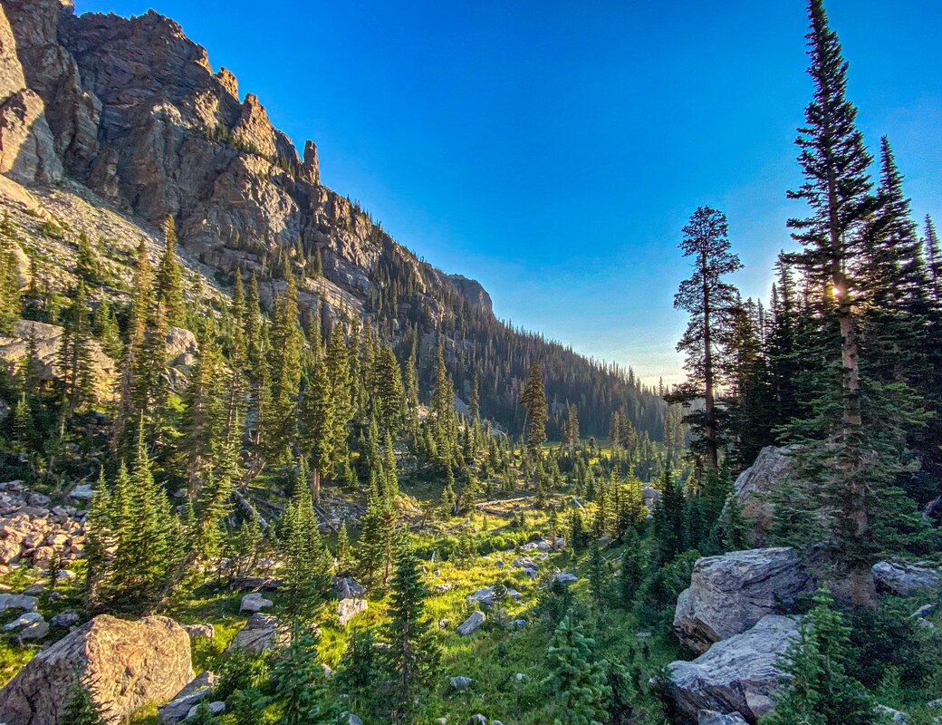
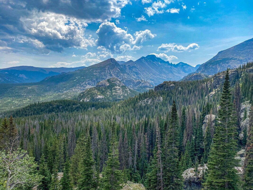


// 7 HIKES + A GLACIER / 5* / 12.5? MILES / 3,500? FT. GAIN / HARD / NO DOGS
Really cool hike - has it all! The hike is a loop with some out and backs attached to the loop. I am going off memory, so you probably want do some research into miles and elevation gain if you decide to do this hike. Plus, there are options in this one. You can lengthen and shorten this hike by taking different routes. I preferred the first half of the hike verses the last half, it that helps? The last half-ish of the hike was also super crowded, but I think I did the hike on a weekend, so may want to keep that in mind. I started, and recommend starting, near sunrise.
This is how I did the loop:
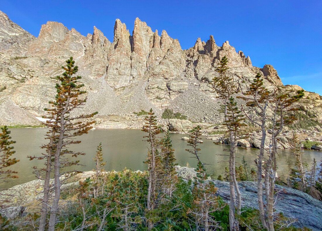
I started with The Loch, then went up to Andrews Glacier (out and back), then to Timberline Falls, Glass Lake, and Sky Pond (out and back), then to lake Halyaha (short out and back), then Dream Lake, and then continued on to Emerald Lake (out and back), then pass by Nymph lake, and finally looping back.
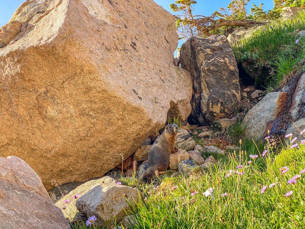
Overall, the hike was amazing! There were many different viewpoints and each lake was totally different and unique (especially loved The Loch, Glass Lake, and Sky Pond), There are a couple waterfalls, a glacier if you do Andrews Glacier (not much glacier left, but still really cool), possible wildlife (saw a few mule deer, marmots, picas, and a woodpecker), and just ever changing and beautiful the whole way! Recommend!
// ALPINE RIDGE / 5* / .7 MILES / 147 FT. GAIN / EASY / NO DOGS
This hike is almost more of a viewpoint, but it's really amazing! A must do! Pretty easy (although it does climb up) and starts from the Alpine Ridge visitor center. If you don't do the "hike", I recommend at least stopping by the visitor center. Hiked in Late August.
// CHIQUITA PEAK / 4* / 5 MILES / 2, 057 FT. GAIN / MODERATE / NO DOGS
Fires were everywhere the day I did this hike, and smokey it was. Probably shouldn't have been out hiking that day, but was. Fortunately, the views were unique because of the smoke, but probably missed out on a lot of what you would normally see. Still a great hike! Some scramble up rocks in the last bit. Lots of marmots. Fun overall. Road to get to the hike was also nice. Caught a beautiful sunrise on the ride in and even saw an elk beside the road.
// IRENE LAKE / 3-4* / .8 MILES / 85 FT. GAIN / EASY / NO DOGS
Again, this one is almost more of a viewpoint. Flat, short, and easy. Trail leads to a beautiful and peaceful lake.
Really cool hike - has it all! The hike is a loop with some out and backs attached to the loop. I am going off memory, so you probably want do some research into miles and elevation gain if you decide to do this hike. Plus, there are options in this one. You can lengthen and shorten this hike by taking different routes. I preferred the first half of the hike verses the last half, it that helps? The last half-ish of the hike was also super crowded, but I think I did the hike on a weekend, so may want to keep that in mind. I started, and recommend starting, near sunrise.
This is how I did the loop:
I started with The Loch, then went up to Andrews Glacier (out and back), then to Timberline Falls, Glass Lake, and Sky Pond (out and back), then to lake Halyaha (short out and back), then Dream Lake, and then continued on to Emerald Lake (out and back), then pass by Nymph lake, and finally looping back.
Overall, the hike was amazing! There were many different viewpoints and each lake was totally different and unique (especially loved The Loch, Glass Lake, and Sky Pond), There are a couple waterfalls, a glacier if you do Andrews Glacier (not much glacier left, but still really cool), possible wildlife (saw a few mule deer, marmots, picas, and a woodpecker), and just ever changing and beautiful the whole way! Recommend!
// ALPINE RIDGE / 5* / .7 MILES / 147 FT. GAIN / EASY / NO DOGS
This hike is almost more of a viewpoint, but it's really amazing! A must do! Pretty easy (although it does climb up) and starts from the Alpine Ridge visitor center. If you don't do the "hike", I recommend at least stopping by the visitor center. Hiked in Late August.
// CHIQUITA PEAK / 4* / 5 MILES / 2, 057 FT. GAIN / MODERATE / NO DOGS
Fires were everywhere the day I did this hike, and smokey it was. Probably shouldn't have been out hiking that day, but was. Fortunately, the views were unique because of the smoke, but probably missed out on a lot of what you would normally see. Still a great hike! Some scramble up rocks in the last bit. Lots of marmots. Fun overall. Road to get to the hike was also nice. Caught a beautiful sunrise on the ride in and even saw an elk beside the road.
// IRENE LAKE / 3-4* / .8 MILES / 85 FT. GAIN / EASY / NO DOGS
Again, this one is almost more of a viewpoint. Flat, short, and easy. Trail leads to a beautiful and peaceful lake.
NORTHERN COLORADO (ABOVE BOULDER)


FORT COLLINS
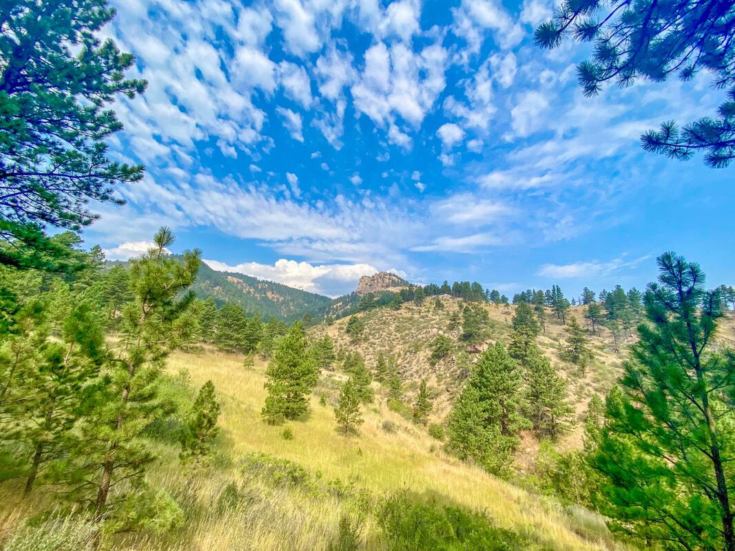
// ARTHUR'S ROCK / 4* / 3.4 MILES / 1,000 FT. GAIN / MODERATE / DOGS
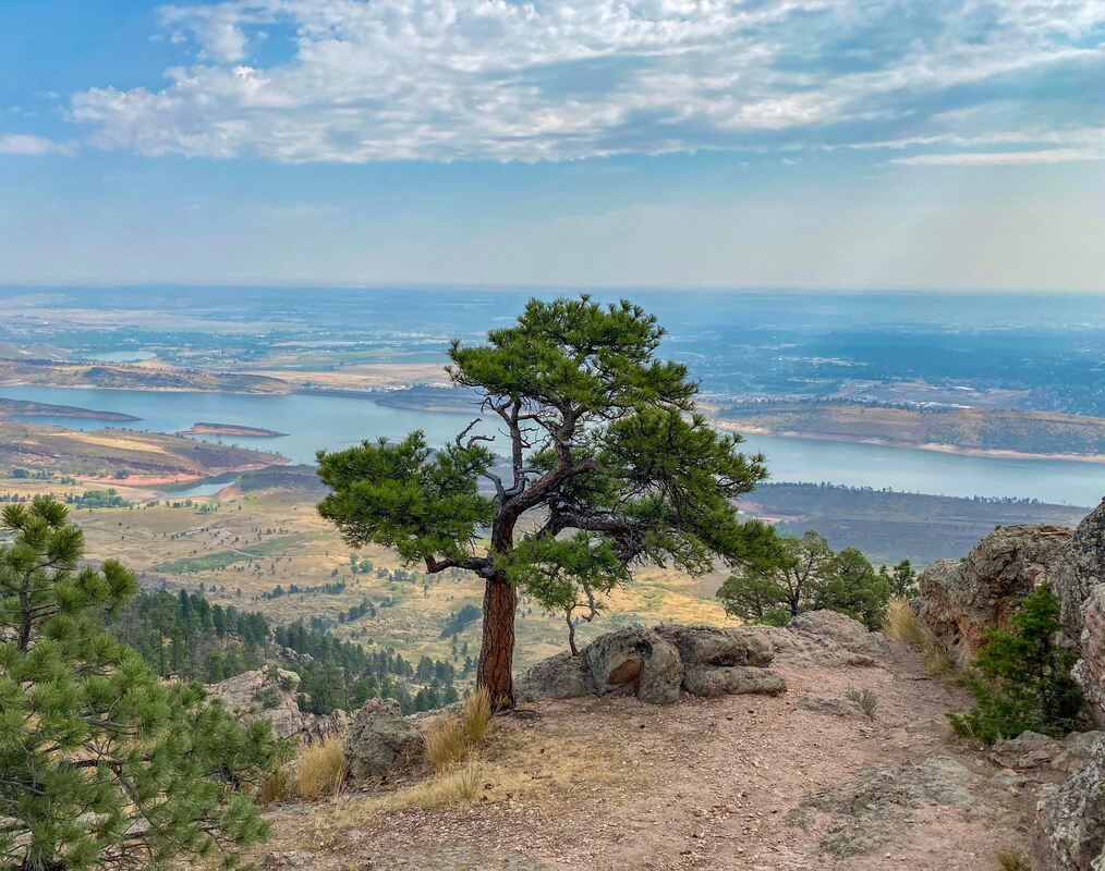
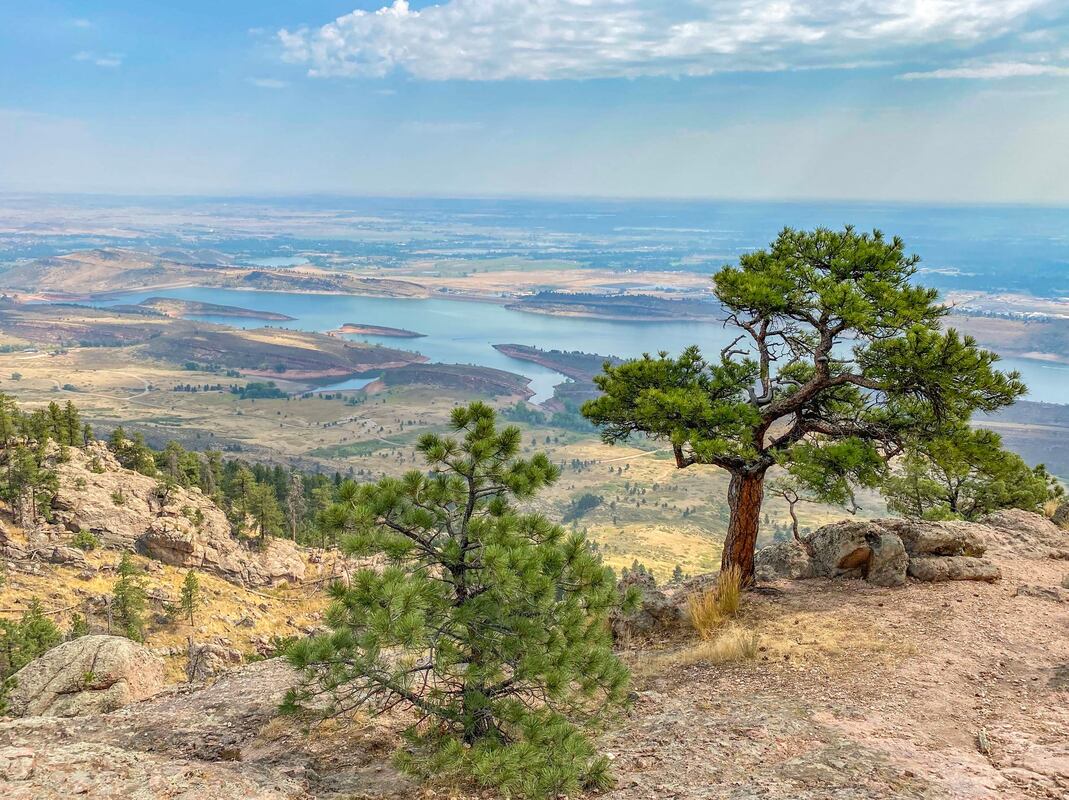
Nice hike up to Arthur's Rock. At the top you are rewarded with fabulous views of the Horsetooth Reservoir. In Lory State Park.
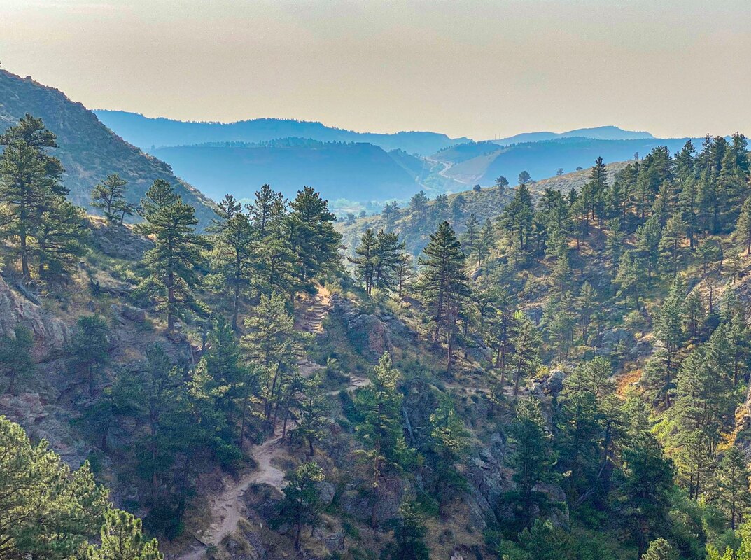
// HORSETOOTH FALLS / 3-4* / 2.2+ MILES / 393+ FT. GAIN / EASY / DOGS
Nice area. In Horsetooth Mountain Open Space. A little dry and no falls when I went In August. Enjoyed the hike none the less.
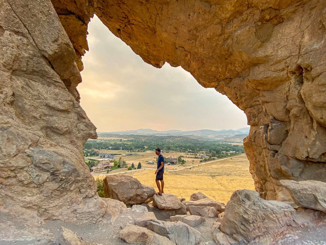
// HORSETOOTH RESERVOIR CLIMBING AREA / 4* / <1 ?MILE / ? FT. GAIN / EASY / DOGS?
Random find while driving by. Followed a path to a nice viewpoint overlooking the Horsetooth reservoir. Cool to see climbers on the walls as well. Not a big hike, but definitely a nice viewpoint.
LOVELAND
// THE KEYHOLE LOOP (DEVIL'S BACKBONE) / 4* / 2.4 MILES / 252 FT. GAIN / EASY / DOGS
Definitely my favorite Loveland trail. The "keyhole" is really cool. Worth visiting if you are in the area.
// LOVELAND LAKE / 3-4* / ? MILES / ? FT. GAIN / EASY / DOGS
Saw some amazing sunsets at Loveland Lake! There are parts you can walk, but a lot of it is private so you can't walk around the whole lake, along the lake itself. Still a nice place to visit, especially for sunset, if you are in town.
// RIVER'S EDGE NATURAL AREA LOOP / 3 / 2.7 MILES / 29 FT. GAIN / EASY / DOGS
Decent spot to visit. I thought it worked well as a trail run. Not the most exciting, but lots of birds, flowers, and marshy ponds. Can take other routes to make it shorter or longer if you desire.
OTHER
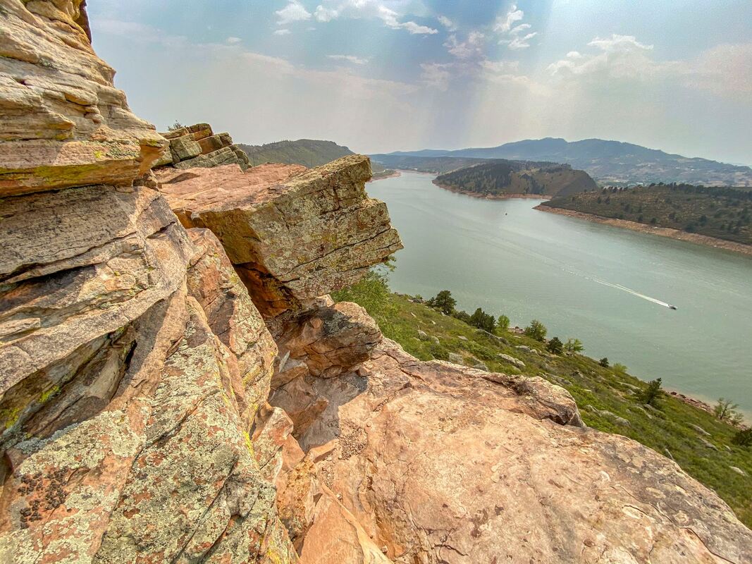
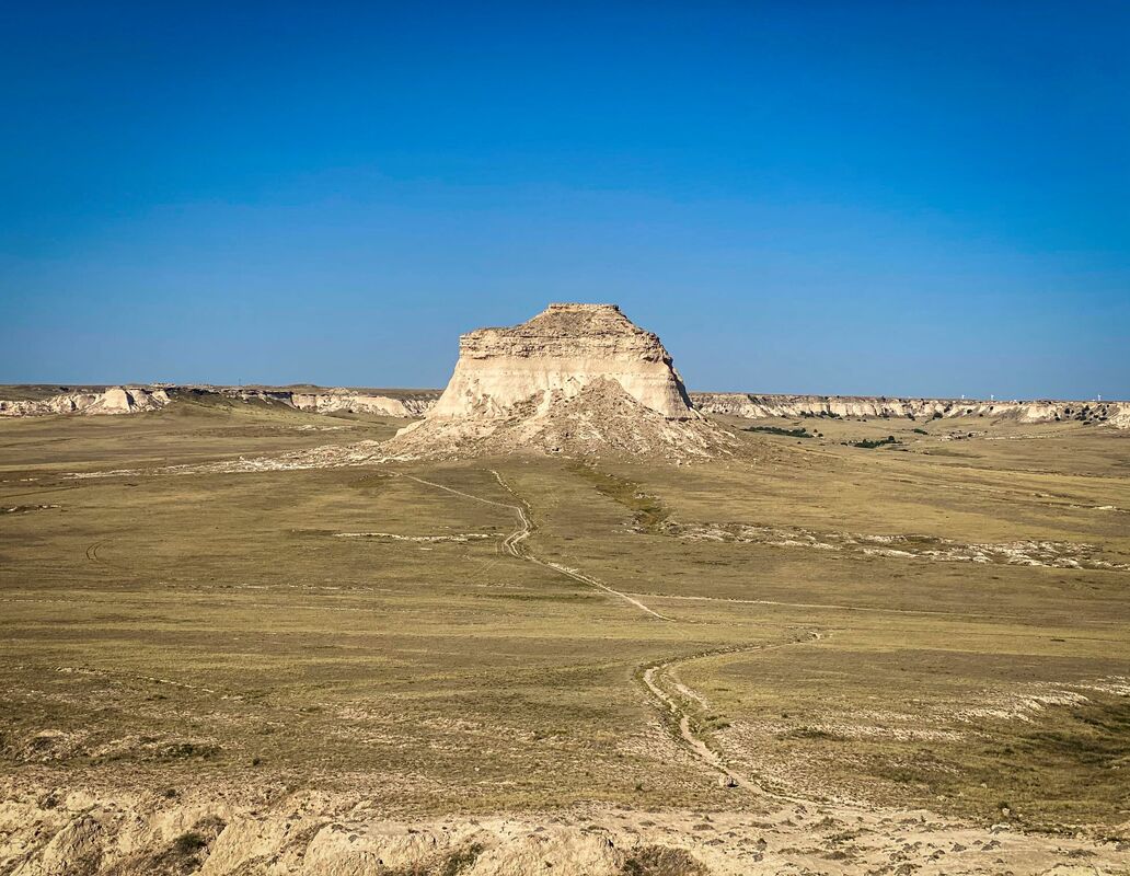
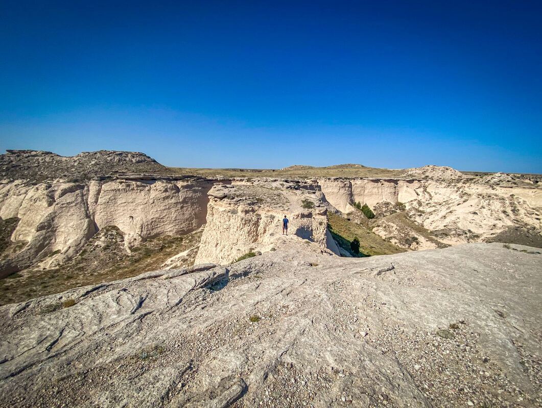
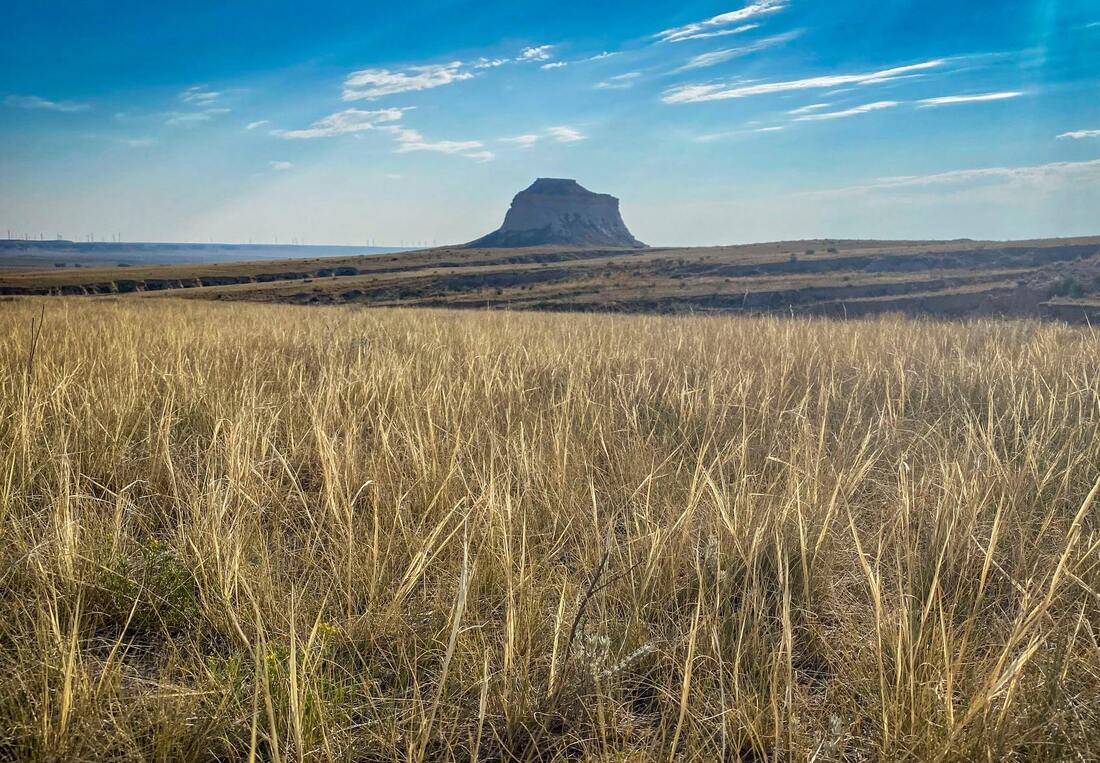
// PAWNEE BUTTES / 4* / 4.7 MILES / 364 FT. GAIN / EASY - MODERATE / DOGS
This hike is out in the middle of nowhere farmland, but it is kind of cool in that way. Also, when I hiked this one, I didn't run into any other hikers the whole time I was there. Overall, the rock formations were interesting and changed up as the trail walked you around them. Finally, the last formation you got to kind of walk through. It was a unique one. Easy hike, but you are totally exposed the whole time so it may seem harder than it should be if it is hot. Bring plenty of water.
// ARTHUR'S ROCK / 4* / 3.4 MILES / 1,000 FT. GAIN / MODERATE / DOGS
Nice hike up to Arthur's Rock. At the top you are rewarded with fabulous views of the Horsetooth Reservoir. In Lory State Park.
// HORSETOOTH FALLS / 3-4* / 2.2+ MILES / 393+ FT. GAIN / EASY / DOGS
Nice area. In Horsetooth Mountain Open Space. A little dry and no falls when I went In August. Enjoyed the hike none the less.
// HORSETOOTH RESERVOIR CLIMBING AREA / 4* / <1 ?MILE / ? FT. GAIN / EASY / DOGS?
Random find while driving by. Followed a path to a nice viewpoint overlooking the Horsetooth reservoir. Cool to see climbers on the walls as well. Not a big hike, but definitely a nice viewpoint.
LOVELAND
// THE KEYHOLE LOOP (DEVIL'S BACKBONE) / 4* / 2.4 MILES / 252 FT. GAIN / EASY / DOGS
Definitely my favorite Loveland trail. The "keyhole" is really cool. Worth visiting if you are in the area.
// LOVELAND LAKE / 3-4* / ? MILES / ? FT. GAIN / EASY / DOGS
Saw some amazing sunsets at Loveland Lake! There are parts you can walk, but a lot of it is private so you can't walk around the whole lake, along the lake itself. Still a nice place to visit, especially for sunset, if you are in town.
// RIVER'S EDGE NATURAL AREA LOOP / 3 / 2.7 MILES / 29 FT. GAIN / EASY / DOGS
Decent spot to visit. I thought it worked well as a trail run. Not the most exciting, but lots of birds, flowers, and marshy ponds. Can take other routes to make it shorter or longer if you desire.
OTHER
// PAWNEE BUTTES / 4* / 4.7 MILES / 364 FT. GAIN / EASY - MODERATE / DOGS
This hike is out in the middle of nowhere farmland, but it is kind of cool in that way. Also, when I hiked this one, I didn't run into any other hikers the whole time I was there. Overall, the rock formations were interesting and changed up as the trail walked you around them. Finally, the last formation you got to kind of walk through. It was a unique one. Easy hike, but you are totally exposed the whole time so it may seem harder than it should be if it is hot. Bring plenty of water.
SOUTH COLORADO

SOUTH COLORADO
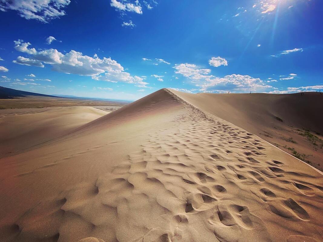
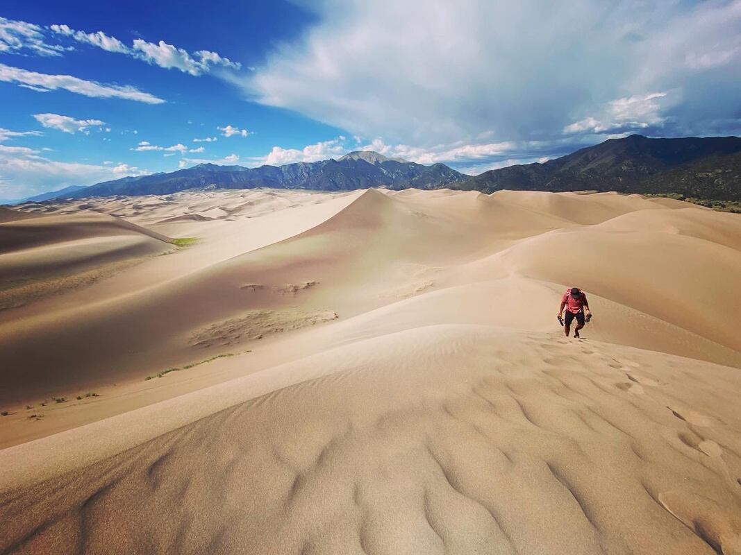
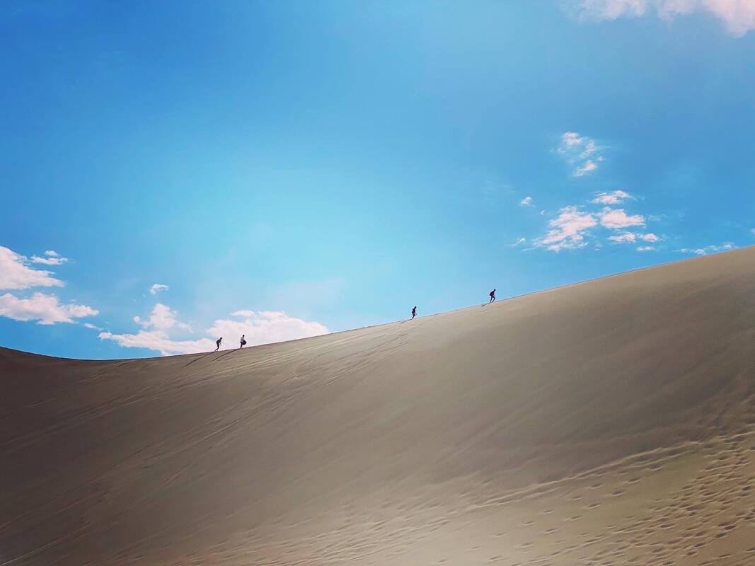
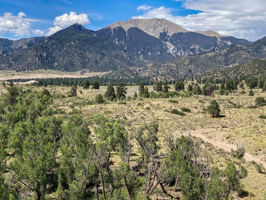
// GREAT SAND DUNES NATIONAL PARK / 5* / VARIABLE DISTANCE / DOGS
I can't remember if we made it up Star Dune, (probably the most popular towering dune in the park) or not. It was in the plans to do so. I feel like we had so much fun just running up and down the dunes we no longer cared if we necessarily made it to the highest point or not. Expect a work out making your way up the dunes, but worth the pay-out of nice views and the thrill of getting to slide your way down - however you do so. Beware, the sand is REALLY HOT during the day. Best not to play on the dunes until dusk. I imagine a full moon night would be amazing here!
// ZAPATA FALLS / 3-4* / 1 MILE / 213FT GAIN / DOGS
I wouldn't go out of my way to do this hike, but it's a great hike to do while visiting "The Great Sand Dunes National Park". The trail is super short, but fun as you have to make your way upstream to get to the falls, which are nice. Expect to get in the water. Trail is easy except for slippery rocks. I believe we drove to the trailhead without any difficulty, but I would check what others say about road conditions if you are concerned.